Late January to February 2025: Over 12,000 earthquakes, mostly of small magnitude, were detected near Greece’s volcanic island of Santorini. The seismic activity prompted authorities to declare a state of emergency, leading to evacuations and heightened monitoring due to concerns about a potential larger earthquake.
The ongoing swarm of earthquakes near Santorini continues to perplex scientists while keeping disaster risk management teams and the public on high alert. Reports of the escalating seismic activity have garnered global attention. Santorini, a vast volcanic caldera with two small islets at its submerged center, has a turbulent volcanic history spanning 650,000 years. The island has experienced catastrophic eruptions, including a devastating blast around 1560 B.C. that contributed to the collapse of a civilization, a significant eruption in A.D. 726, and a moderate one in 1950. Given its active volcanic status, the region remains under close scrutiny.
Since January 31, 2025, seismic activity has surged across a 250 km² area northeast of Santorini, near the fault believed responsible for the July 9, 1956, Amorgos earthquake and tsunami. This has raised concerns among experts, who are closely monitoring the evolving situation. According to a report dated February 9, prepared by Prof. Ahmet Yalciner and a team of experts in collaboration with the National Observatory of Athens (NOA), over 1,200 earthquakes have been recorded between January 25 and February 7, with magnitudes ranging from 1.0 to 5.2. Among these, 129 earthquakes exceeded magnitude 4.0, with the strongest recorded at ML 5.2. Most quakes occurred at depths between 10 and 15 km, forming a NE-SW trending cluster east of Anydros Island.
The seismic activity is cantered within the Anydros Uplift (Anydros Horst), positioned between the NW-dipping Anydros Fault and the SE-dipping Santorini-Anafi Fault. Initial data analysis indicates an increase in earthquake magnitudes during the early phase of the swarm.
Tsunami modelling studies have been undertaken to assess potential risks associated with tectonic and volcanic activity in the region. The simulations examine possible tsunami scenarios affecting the islands of Santorini, Amorgos, Astypalaea, and Anafi, with a particular focus on the Aegean coast of Türkiye.
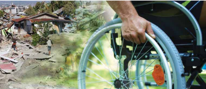
Growing Public Concerns and Evacuations
Denis Chang Seng, UNESCO-IOC Programme Specialist and Technical Secretary of ICG-NEAMTWS, emphasized that beyond scientific debate over the causes, a crucial issue demanding attention from disaster risk management and response teams is the self-initiated evacuation of Santorini residents. Human risk perception plays a pivotal role in such scenarios, influenced by proximity to the perceived hazard, past disaster experiences, and public trust in authorities. Although individual factors such as media coverage, age, gender, education, and income levels may not be primary drivers of risk perception, they can amplify core factors influencing public response.
According to BBC News, by February 6, over 11,000 people had fled Santorini—7,000 via ferry and 4,000 by air—due to the escalating situation. In response, Greece declared a state of emergency for Santorini on February 5, following a 5.2-magnitude earthquake at 21:09 local time (19:09 GMT) between Amorgos and Santorini. The emergency decree, effective until March 3, aims to address urgent needs and manage the situation. Greek Prime Minister Kyriakos Mitsotakis reassured the public, stating, “All plans have been implemented. Forces have been moved to Santorini and the other islands so that we are ready for any eventuality.” Despite heightened seismic activity, no significant damage has been reported on the island thus far.
The Role of the
UNESCO-IOC Tsunami Warning and Mitigation System
Amid the unfolding seismic activity, the importance of the UNESCO-IOC Intergovernmental Coordination Group for the Tsunami Early Warning and Mitigation System in the North-Eastern Atlantic, the Mediterranean, and Connected Seas (ICG-NEAMTWS) has come to the forefront. This system coordinates tsunami risk management across 40 member states with access to the Mediterranean, Baltic, North, and Black Seas. Currently, the system is designed to detect and respond to seismic-driven tsunamis, with ongoing efforts to expand its scope to include non-seismic tsunamis, such as those caused by volcanic eruptions and landslides.
To enhance coordination, the UNESCO-IOC Technical Secretary of ICG-NEAMTWS has requested its Steering Committee, composed of representatives from multiple countries, to share insights on the evolving situation. A dedicated, independent communication channel has been established between the Technical Secretary, the Hellenic National Tsunami Warning Center (HL-NTWC) at NOA, and Türkiye’s Kandilli Observatory and Earthquake Research Institute (KOERI) to facilitate the rapid exchange of critical information, particularly during nighttime and weekends.
Furthermore, NEAMTWS Tsunami Service Providers are organizing a meeting to review operational procedures and communication strategies for member states, with special attention to non-seismic tsunami events. Additionally, experts are considering a closed scientific meeting to assess the evolving seismic activity near Santorini. In response to the growing concerns, the Hellenic National Tsunami Warning Center (HL-NTWC) swiftly installed a new tide gauge station at Pori on Santorini’s northeastern coast. This new station is expected to significantly enhance sea-level monitoring and strengthen early warning capabilities.
Looking Ahead
With different schools of thought on the causes and triggers of the ongoing earthquake swarm, continued research and monitoring will be key in reaching a scientific consensus. The situation remains dynamic, and disaster risk professionals will continue to emphasize preparedness, timely communication, and proactive measures to ensure public safety in Santorini and the surrounding region.
Acknowledgments: Thanks to Dr. Nikos Kalligeris, Dr. Marinos Charalampakis (Institute of Geodynamics, NOA, Greece), Prof. Ahmet Cevdet Yalciner (Middle East Technical University, Türkiye), Prof. Dr. Nurcan Meral Özel (Director, Kandilli Observatory and Earthquake Research Institute, Türkiye), and Dr. Musavver Didem Cambaz (RETMC Deputy Director) for their insights and feedback.
Source:
www.unesco.org