Your cart is currently empty!
Category: Know Disasters
Urban Flooding in Mumbai: Lessons from 2024
Rutuj Mahendra Salunke is a master’s graduate in Disaster Management from the Tata Institute of Social Sciences (TISS). With a deep understanding of disaster risk reduction and resilience, Rutuj brings significant field experience from both urban and rural settings. He currently works as an assistant editor for the Known Disasters Magazine, contributing his expertise in content creation, editing, and disaster-related journalism.
In this article, we will explore the challenges of urban flooding in Mumbai, particularly highlighted by the events of 2024, and examine potential solutions to improve flood management. We will discuss the role of citizen science, crowdsourced data, and advanced technology in enhancing real-time flood monitoring and mitigation. Additionally, we will highlight the importance of integrating these modern approaches with traditional infrastructure to create more resilient systems, ensuring Mumbai is better prepared to face future floods in the wake of climate change.
Urban Flooding in Mumbai: Lessons from 2024
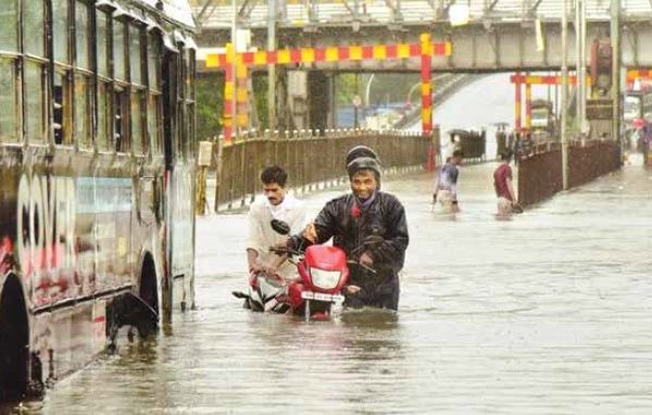
Mumbai, one of the largest and most densely populated cities in India, has long been susceptible to urban flooding due to a combination of intense monsoon rains, inadequate drainage systems, and rising sea levels. In 2024, the city once again experienced severe flooding, bringing to the forefront the urgent need for more effective and accessible flood monitoring and mitigation strategies. Despite efforts by the Brihanmumbai Municipal Corporation (BMC), gaps remain in creating a robust and citizen-friendly early warning system. This article delves into the challenges Mumbai faces in managing floods and explores potential solutions using crowdsourced data and citizen science.
Every Monsoon, Mumbai braces itself for floods, a recurring event that has plagued the city for decades. While the Brihanmumbai Municipal Corporation (BMC) has implemented several measures that have reduced flooding in certain areas, the problem still persists. Why?
Mumbai’s vulnerability to floods stems from a combination of geographical, infrastructural, and climatic factors. Built on a collection of seven islands, the city’s reclamation projects have created low-lying coastal tracts. Many of these areas sit just 1 meter above sea level or even below the high tide level, making them particularly prone to flooding. This, combined with outdated drainage systems and increasing climate variability, sets the stage for the city’s annual struggle with monsoon floods.
Why Does It Flood in Mumbai?
The answer is multifaceted. According to the Flood Preparedness Guidelines 2023, three primary factors contribute to flooding in the city:
1. Localized flooding due to inadequate drainage systems.
2. Overflow from the Mithi River, especially during heavy rains.
3. A combination of high tides and high river flows, which exacerbate flooding in coastal areas.
Mumbai’s drainage system, designed decades ago, is no longer equipped to handle the intensity and frequency of modern rainfall patterns. Originally constructed to manage 25 mm of rainfall per hour, the system is overwhelmed during heavy downpours. An official from BMC’s Storm Water Drains (SWD) Department explained that while the drains are designed for moderate rainfall spread over time, the city now often experiences intense rainfall over short periods, leaving the system unable to cope with the water volume.
The Role of Citizen Science in Urban Flood Management
Citizen science plays a critical role in enhancing urban flood management by empowering local communities to actively contribute to real-time monitoring and data collection. In densely populated cities like Mumbai, where traditional flood forecasting systems often face limitations, citizen science offers a practical and scalable solution. Citizens, through the use of mobile phones, social media platforms, and other accessible technologies, can report on-the-ground conditions such as water levels, flood locations, and blocked drains. This crowdsourced information can fill crucial gaps in official data and provide authorities with valuable insights into how floods are impacting specific areas in real time.
One of the major advantages of integrating citizen science into urban flood management is its ability to generate hyper-localized data. In many cases, official systems struggle to capture flooding at a street or neighbourhood level, but citizens can provide granular details from their immediate surroundings. For example, platforms like Twitter have been effectively used to gather reports of waterlogging and floods in Mumbai, enabling authorities to respond more rapidly to emerging issues. When combined with other technologies such as geographic information systems (GIS) and satellite data, this citizen-generated information can significantly enhance the accuracy of flood monitoring and forecasting.
Moreover, citizen science fosters a sense of ownership and community engagement in managing urban floods. When residents are involved in the data collection process, they become more aware of flood risks and proactive in mitigating them. Programs that train volunteers to act as live sensors, as seen in some parts of Mumbai, have not only improved the quality of flood-related data but also created a more informed public. These volunteers, equipped with mobile apps and tools like WhatsApp or Google forms, provide real-time updates on flood-prone areas, helping local authorities prioritize their responses.
Beyond real-time monitoring, citizen science can also contribute to long-term flood resilience planning. Crowdsourced data helps identify chronic flood hotspots and evaluate the effectiveness of mitigation measures over time. By analyzing trends in waterlogging reports and comparing them with rainfall patterns, decision-makers can adjust strategies to better protect vulnerable areas. This data-driven approach supports more efficient resource allocation and infrastructure investments, ultimately leading to more resilient urban environments.
Incorporating citizen science into urban flood management thus holds tremendous potential for improving preparedness and response in cities like Mumbai. As climate change continues to increase the frequency and intensity of extreme weather events, leveraging the collective knowledge and experience of citizens will be essential for building adaptive, community-centered flood management systems.
However, the reliance on citizen science and social media for real-time flood monitoring highlights a key gap: Mumbai still lacks a dependable, end-to-end flood forecasting and early warning system. While BMC’s efforts have led to reduced flooding in certain areas, the absence of a comprehensive, citizen-accessible system limits the city’s ability to plan for and respond to floods effectively.
The Future of Flood Forecasting: Citizen Science as a Solution
As climate change intensifies the frequency, duration, and severity of extreme weather events, innovative approaches to disaster risk reduction will become increasingly important. The Intergovernmental Panel on Climate Change (IPCC) report emphasizes the need for community-based solutions in urban areas. The integration of crowdsourced data, as demonstrated in this study, shows significant promise in contributing to modern decision-making systems for urban flooding.
By leveraging advanced techniques such as sentiment analysis and natural language processing, crowdsourced data can be harnessed more effectively to generate reliable early warning systems. When citizens see their contributions being used to save lives, their involvement is likely to increase, further enhancing the accuracy and usefulness of the data.
Lessons from 2024: Mitigation Strategies in Action
The floods of 2024 have provided a critical learning opportunity, shedding light on both the successes and shortcomings of Mumbai’s flood mitigation strategies. One of the most significant lessons from recent years is the observable decline in waterlogging reports, particularly between 2020 and 2022, despite sustained and sometimes intense rainfall. This trend suggests that the city’s proactive flood management measures have been partially successful. The decrease in reported flood incidents was further validated through systematic surveys conducted at various known flood hotspots. Local authorities confirmed the effectiveness of many of the implemented measures, reinforcing the idea that while challenges remain, progress has certainly been made.
One of the key strategies contributing to these successes has been the installation of advanced pumping systems in flood-prone areas. Public used to witness severe flooding on street, improvements such as water pumps have made a tangible difference. The experience of floods diminishing in frequency, except during particularly heavy rains, echoes the broader findings of reduced waterlogging in many other areas of Mumbai. This improvement can be attributed to a more comprehensive approach to managing stormwater, which includes clearing drainage systems and maintaining pumping stations.
The Brihanmumbai Municipal Corporation (BMC) deserves recognition for its proactive flood management efforts, which have greatly reduced the loss of life and damage to property in recent years. The BMC’s focus on addressing waterlogging hotspots, reducing them from 440 to 84 over time, is commendable and indicates that their strategies are working in many parts of the city. These efforts have also included the expansion and maintenance of stormwater drainage networks, which are essential for preventing the rapid accumulation of water during heavy rainfall events.
Despite these strides in flood mitigation, one of the most critical gaps still remains: the lack of an end-to-end, real-time flood forecasting system that is easily accessible to the public. While BMC’s efforts in reducing waterlogging have shown progress, the absence of an integrated early warning system severely limits Mumbai’s ability to respond to sudden, extreme weather events. The 2024 floods have made it clear that without a comprehensive, real-time monitoring system, both authorities and citizens are left at a disadvantage when it comes to planning for and responding to floods.
Looking forward, the lessons from 2024 underline the need for continued investment in flood management systems that are dynamic, data-driven, and accessible to the public. The integration of technology, citizen science, and real-time data will be key in ensuring that Mumbai becomes more resilient to future floods, especially in the face of climate change, which is expected to increase the frequency and intensity of extreme rainfall events. A modern flood forecasting system, built on these principles, could significantly reduce the impact of future floods on one of the world’s most densely populated cities.
What Lies Ahead?
The future of flood management in Mumbai lies in integrating traditional mitigation measures with advanced technological solutions. The Intergovernmental Panel on Climate Change (IPCC) report emphasizes the importance of community-based solutions in disaster risk reduction. Crowdsourced data, as explored in this study, offers a promising way to fill the gaps in real-time flood monitoring.
In the coming years, leveraging data from platforms like Twitter and VGI can help authorities develop street-level flood forecasting systems. By combining this data with numerical and physics-based models, Mumbai could create a modern decision system that allows for more precise and effective flood responses. As the city continues to face the challenges posed by climate change, such systems will become increasingly crucial. The events of 2024 serve as a stark reminder of Mumbai’s vulnerability to urban flooding, yet they also highlight the potential for transformative solutions. The integration of citizen science, crowdsourcing, and advanced technology presents a promising pathway toward more efficient flood management. While mitigation strategies have led to significant improvements, such as a reduction in waterlogging hotspots and minimized losses, critical gaps remain—particularly the need for a real-time, end-to-end flood forecasting system accessible to the public. By harnessing the power of crowdsourced data and combining it with cutting-edge technology like numerical modeling, Mumbai can develop more resilient flood management systems. The use of platforms such as Twitter and Volunteered Geographic Information (VGI) has already proven effective in identifying flood-prone areas, providing granular, real-time data to inform decision-making. With continued investment in both traditional infrastructure and technological innovation, the city can minimize the impacts of future floods, transforming crowdsourced data into life-saving early warnings, and ensuring that urban areas are better prepared to face the growing challenges posed by climate change.
Uttarakhand Floods: Early Warning Systems, Evacuation Plans and It’s Effectiveness
Neeharika Chauhan is a highly skilled Project Associate (DRR) at Geo Climate Risk Solutions Pvt. Ltd., based in Uttarakhand, a region frequently impacted by natural disasters. With a solid academic and professional background in disaster management, she brings comprehensive expertise in risk assessment and mitigation strategies, complemented by substantial field experience. Her commitment to strengthening community resilience against climate-related risks is evident in her proactive approach to implementing effective, evidence-based solutions. Neeharika’s deep understanding of the local landscape and her technical expertise make her a critical asset in advancing disaster management efforts in Uttarakhand’s challenging environmental context
This article explores the critical role of early warning systems and evacuation plans in mitigating the impacts of floods in Uttarakhand, a state vulnerable to natural disasters. It examines advancements such as the Uttarakhand Multi-Hazard Early Warning System, which integrates technology with community engagement to enhance disaster preparedness. The effectiveness of existing systems is assessed, highlighting lessons learned from past flood events, including the catastrophic floods of 2013, 2021 and 2023. The article emphasizes the importance of comprehensive evacuation protocols, community involvement, and continuous improvements to ensure timely responses and ultimately safeguard lives in this ecologically sensitive region.
Uttarakhand, a state known for its majestic mountains and serene rivers, has also witnessed devastating floods in recent years, particularly in 2013 and 2023. These disasters have highlighted the urgent need for effective early warning systems and evacuation plans to protect lives and minimize damage
The Importance of Early Warning Systems
Early Warning Systems (EWS) play a critical role in disaster preparedness, particularly in mountainous regions that are vulnerable to floods. These systems facilitate the monitoring of weather patterns, hydrological data, and other key indicators that provide early signals of potential disasters. In regions such as Uttarakhand, where monsoon rainfall is highly unpredictable and the complex topography presents additional challenges, the development and implementation of advanced EWS are essential to mitigate risks and enhance preparedness.
The Indian Meteorological Department (IMD) holds a critical responsibility in delivering weather forecasts and issuing warnings. Recent technological advancements, such as satellite imagery and remote sensing, have significantly enhanced the accuracy of these predictions. Despite these improvements, a major challenge persists in ensuring the timely and effective dissemination of this information to at-risk communities, particularly those located in remote and inaccessible regions of Uttarakhand’s complex terrain.
Uttarakhand Multi-Hazard Early Warning System: A Step Towards Resilience
One of the most significant advancements in Uttarakhand’s disaster preparedness is the Uttarakhand Multi-Hazard Early Warning System. Announced on June 24, 2023, this project is designed to enhance the state’s capacity to respond to various natural calamities, including floods, landslides, and earthquakes. With an initial budget of ₹118 crore approved by the High Powered Committee, and funding from the World Bank, this initiative aims to install sirens at 250 strategically chosen locations across the state as part of its first phase.
The unique aspect of this early warning system is its integration with mobile communication infrastructure. Sirens will be mounted on existing mobile towers in sensitive areas, with new towers installed where necessary. Alerts generated by the Indian Meteorological Department (IMD) and the Central Water Commission will be disseminated through these sirens, ensuring timely notifications to communities at risk.
One of the innovative features of the Uttarakhand Multi-Hazard Early Warning System is its ability to issue distinct sounds for different types of disasters. This approach not only alerts residents but also educates them about the nature of the impending threat, allowing for quicker, more informed responses. Control rooms at three levels—local, district, and state—will manage the activation of the sirens, ensuring comprehensive coverage and responsiveness in emergency situations.
As Uttarakhand embarks on this journey towards enhanced disaster preparedness, it sets a precedent as the second state in India to adopt such a system, following Kerala’s initiative. With plans to expand the siren network to 1,000 locations in subsequent phases, this project represents a vital step in safeguarding lives and properties against the backdrop of the region’s vulnerability to natural disasters.
Effectiveness of Existing Systems
While Uttarakhand has made significant strides in developing early warning systems (EWS) for natural disasters, the effectiveness of these systems can vary widely based on several factors, including geographical and infrastructural challenges. The catastrophic events of 2013, where the failure to provide timely alerts resulted in the loss of thousands of lives and widespread property damage, highlighted critical gaps in disaster preparedness. This tragedy prompted a comprehensive evaluation of existing protocols and served as a catalyst for reform in the state’s disaster management approach.
The Indian Meteorological Department (IMD) significantly enhanced its Early Warning Systems (EWS) in Kerala during a period of heavy rainfall. Building on lessons from past disasters, IMD issued more detailed and timely alerts from July 30, 2024 onward, which played a crucial role in facilitating evacuations from vulnerable areas. These alerts highlighted the risks of landslides, flash floods, and general flooding. The updated system not only categorized weather conditions through color-coded alerts—green, yellow, orange, and red—but also introduced an impact-based forecasting approach. This shift allowed authorities to better prepare for disasters by linking alerts with potential impacts, improving decision-making. Although some critiques emerged regarding IMD’s conservative approach, their enhanced methodology led to more effective disaster response and showcased how a well-coordinated EWS can mitigate risks (Unnikrishnan S, 2024) .
Local authorities, NGOs, and community leaders played a vital role in ensuring that these warnings reached those most at risk. On the morning of February 7, local residents observed a massive cloud of dust and ice rapidly flowing through the Rishi Ganga river, signalling an impending disaster. Despite their efforts to alert others, the warning systems installed at nearby hydropower projects, including Rishi Ganga and Tapovan Vishnugad, failed to activate in time. The sheer volume of ice and debris from the Glacial Lake Outburst Flood (GLOF) overwhelmed the alarm systems, preventing timely warnings. Community members played a crucial role in responding to the incident, but the disaster exposed significant gaps in the existing early warning infrastructure. Moving forward, it has been determined that government-backed early warning systems will be installed, specifically to monitor glacier activity, to better protect downstream projects and communities (Jayashree N., Joshimath 2021).
Moreover, the reliance on technology must be complemented by community knowledge and engagement to ensure that the information is understood and acted upon promptly. Strengthening the resilience of these communities involves not only enhancing technological systems but also investing in local capacity building and infrastructure development. This holistic approach is essential for improving the reach and impact of early warning systems, ensuring that even the most vulnerable populations are adequately informed and prepared for impending disasters. By addressing these ongoing challenges, Uttarakhand can further enhance its disaster preparedness and ultimately save lives during future emergencies.
Uttarakhand Floods 2024: A Crisis in the Mountains
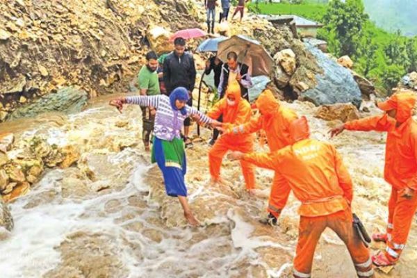
On August 5, 2024, Uttarakhand faced severe repercussions from flash floods and cloudbursts, highlighting the ongoing vulnerabilities of this ecologically sensitive region. The aftermath of intense rainfall on July 31 resulted in the tragic loss of 17 lives and injuries to 25 others(Sphere India Situation Report 1, 2024). The situation worsened as key routes, including the Kedarnath Yatra, were rendered hazardous due to the destruction of both concrete and footbridges along the trek. Critical areas like Ghoraparav, Lincholi, Badi Lincholi, and Bhimbali were obstructed by boulders, underscoring the urgent need for enhanced disaster management strategies to protect lives and property in such vulnerable zones
The State Disaster Response Force (SDRF) personnel are actively engaged in rescue missions to assist stranded pilgrims along the Kedarnath Yatra route. The National Disaster Management Authority (NDMA) has issued a ‘red alert’ for the state, warning of extremely heavy rainfall in districts such as Dehradun, Champawat, Haridwar, Nainital, Pauri Garhwal, Tehri Garhwal, and Udham Singh Nagar.
Key Impact and Casualties
The torrential rains not only led to flooding but also caused the collapse of residential structures, trapping hundreds of people. Specifically, the Kedarnath pilgrimage route was severely affected, with both concrete and footbridges damaged, leading to the suspension of the Kedarnath Yatra due to hazardous conditions. Trekking routes were obstructed by boulders in areas such as Ghoraparav, Lincholi, Badi Lincholi, and Bhimbali, further complicating rescue efforts.
Statistics and Current Situation
The scale of the disaster is highlighted by several key statistics:
• Casualties: 17
• Injured: 25
• Roads Affected: 70 in the last 24 hours
• Pilgrims Airlifted: 10,374 in the last four days
• Pilgrims Stranded: 120
Data Source- Sphere India
As of August 5, approximately 882 relief personnel are engaged in providing essential services such as food, water, and temporary shelters for stranded individuals. The Indian Army is constructing a temporary bridge at Sonprayag to facilitate the evacuation process.
The Bal Ganga and Budhakedar areas of the Bhilangana development block in Tehri Garhwal experienced heavy rains and landslides, exacerbating the situation. The Indian Meteorological Department has forecasted continued heavy rainfall in various parts of Uttarakhand until August 8, further raising concerns about additional flooding and landslides. In a notable effort to improve road safety in the Budhakedar area, the government approved ₹8 crore for necessary infrastructure improvements, with the Irrigation Department directed to expedite the tender process.
Government and Rescue Operations
In response to the crisis, the Uttarakhand government has initiated several measures to assist affected residents and pilgrims. The Central Government deployed two Indian Air Force helicopters—Chinook and MI 17—to aid in rescue operations following a review by the Prime Minister’s Office. The Chief Minister of Uttarakhand conducted field inspections in Rudraprayag, assessing the extent of the damage and coordinating relief efforts.
Uttarakhand Disaster Management and Rehabilitation Secretary Vinod Kumar Suman said that a total of 7,234 passengers were rescued by August 2. On August 3, an additional 1,865 passengers were rescued and taken to safe locations, bringing the total to 9,099 passengers rescued by August 3 (Kamal K., 2024, JND).
Chief Minister Pushkar Singh Dhami assured that there will be no shortage of funds for disaster relief efforts. During his inspections, he instructed the Commissioner of Garhwal Division to oversee disaster relief camps and ensure adequate support for displaced families, including power backup, access to television, educational resources for children, and livelihood assistance.
Community and NGO Response
Non-governmental organizations and community groups are mobilizing to address the urgent needs of affected families. Following a cloudburst in Ghansali, Tehri Garhwal, 90 families are in immediate need of assistance. Organizations such as the Revitalizing Rainfed Agriculture Network (RRAN) and the Mount Valley Development Association (MVDA) have launched humanitarian appeals to secure resources for food, clothing, temporary shelters, and water purifiers.
The floods in Uttarakhand serve as a stark reminder of the vulnerabilities faced by mountainous regions in the face of climate change and extreme weather events. As the state navigates this crisis, the effectiveness of early warning systems and evacuation plans will be critical in minimizing future risks and enhancing community resilience. The recent disaster underscores the importance of proactive disaster management strategies, timely government responses, and community engagement to safeguard lives in such ecologically sensitive areas.
Evacuation Plans: A Critical Component
Evacuation is a crucial aspect of disaster management, representing the planned relocation of individuals from dangerous or potentially hazardous areas to safer locations. This process is designed not only to protect lives but also to ensure the well-being of communities during emergencies, such as floods, landslides, or other natural disasters. Effective evacuation plans are essential components of comprehensive disaster management strategies, particularly in regions prone to severe weather events like Uttarakhand.
To ensure successful evacuations, comprehensive disaster management plans, such as the Village and Block Disaster Management Plans, must be developed and regularly updated. These plans should detail the identification of shelter sites, which need to be located within a reasonable distance—ideally no more than a one-hour walk or within five kilometres of residents’ homes. Additionally, alternative evacuation routes must be established well in advance to facilitate smooth and timely relocations. This forward-thinking approach mitigates panic and disorganization, which can often lead to chaos during emergencies. Moreover, the involvement of local authorities, law enforcement, and community organizations is crucial for maintaining order and security during evacuations.
The effectiveness of evacuation plans can be enhanced through community engagement, training, and regular drills. These activities empower residents with the knowledge and skills needed to respond effectively during an emergency. Educating the community about the evacuation process, including what to take and where to go, can significantly reduce confusion and save lives. Families should be encouraged to prepare emergency kits containing essential items such as food, water, clothing, toiletries, and important documents. By promoting preparedness at the household level, communities can respond more effectively when the need to evacuate arises.
Effectiveness of Evacuations in Disaster Response
The effectiveness of evacuation plans is ultimately determined by their ability to save lives and reduce suffering during emergencies. The success of such plans can be observed in the way they facilitate timely evacuations and the establishment of safe zones for displaced individuals. In Uttarakhand, the state’s government has initiated the creation of detailed evacuation plans that involve mapping vulnerable areas and identifying safe zones where evacuees can find shelter. This proactive approach is crucial, as it allows authorities to assess risks and allocate resources effectively, thereby enhancing the overall disaster response framework.
The integration of early warning systems (EWS) with evacuation plans is particularly significant in maximizing the effectiveness of emergency responses. Timely alerts from the Indian Meteorological Department (IMD) enable local authorities to execute evacuation protocols promptly, as seen in instances following heavy rainfall in Kerala 2024. The coordination between various stakeholders—including government agencies, NGOs, community leaders, and local residents—is essential for ensuring that warnings reach those most at risk and that evacuation processes run smoothly.
The persistent difficulties in accessing remote and isolated areas emphasize the critical need for ongoing enhancements in evacuation strategies. Establishing a framework for continuous knowledge exchange regarding terrain developments and fostering regular coordination among regional authorities is essential for ensuring timely updates and improving disaster response capabilities. In these regions, where infrastructure may be lacking, reliance on technology alone is insufficient. Community knowledge and engagement play a critical role in overcoming these challenges, as locals can offer valuable insights into the most effective evacuation routes and the best places for shelters. By fostering collaboration between government authorities and community members, Uttarakhand can enhance its disaster preparedness and response capabilities. Regular training, drills, and awareness campaigns should be conducted to ensure that all stakeholders understand their roles during an evacuation.
Effective evacuation planning is a cornerstone of disaster risk reduction in Uttarakhand. By recognizing the unique challenges posed by the region’s topography and climate, the state can develop robust strategies that prioritize the safety and well-being of its residents. Through community engagement, comprehensive planning, and the integration of early warning systems, Uttarakhand can improve the effectiveness of its evacuation processes, ultimately safeguarding lives and fostering resilience in the face of natural disasters.
Capacity Building for Disaster Management: A Comprehensive Approach
Capacity building in disaster management is crucial for enhancing the resilience of communities and minimizing the impacts of disasters. It involves developing the skills, knowledge, and infrastructure necessary to effectively prepare for, respond to, and recover from emergencies. At its core, capacity building is about empowering individuals and organizations with the expertise and resources required to manage disasters efficiently. As the frequency and intensity of disasters increase globally, the importance of robust capacity building programs has never been more evident.
The first step in this process is recognizing that the ability to withstand and respond to disasters hinges on having well-trained personnel and efficient emergency response mechanisms. Training is essential, as it equips various stakeholders—including government agencies, non-governmental organizations (NGOs), and community members—with the skills they need to act swiftly during a crisis. This involves practical training in search and rescue operations, first aid, and shelter management. For example, training police forces, home guards, and health department members in disaster-specific scenarios—such as earthquakes, landslides, and fires—ensures that these individuals are prepared to handle real-life emergencies with confidence and effectiveness. (usdma.uk.gov.in)
Moreover, advanced training courses can significantly enhance the capabilities of responders. Implementing specialized programs, like advanced search and rescue courses, can refine the skills of personnel to deal with complex disaster scenarios. It is also essential to regularly assess the training needs of various stakeholders to ensure that the training provided is relevant and up to date. This assessment process can help identify gaps in knowledge and skills, allowing for the development of tailored training programs that address specific community needs.
In addition to formal training, capacity building should include community awareness initiatives. Empowering local populations through knowledge-sharing sessions can foster a culture of preparedness. By involving youth organizations such as the National Cadet Corps (NCC) and local clubs, disaster management training can reach diverse demographics, ensuring that community members understand their roles during emergencies. The involvement of NGOs is also pivotal in this context. They can leverage local knowledge and resources, engage communities in preparedness activities, and promote a sense of self-reliance.
A crucial aspect of capacity building is the establishment of effective control rooms and emergency operation centers (EOCs) equipped with state-of-the-art technology. These facilities should operate continuously to coordinate disaster response activities efficiently. The integration of technology into disaster management not only streamlines communication but also facilitates better resource allocation during emergencies.
Another vital component of capacity building is training technical manpower, including architects, engineers, and planners, in disaster-resistant infrastructure design and construction practices. By prioritizing training for these professionals, we can ensure that future developments are resilient to disasters. This forward-thinking approach is essential in reducing vulnerability and enhancing the overall safety of communities.
Ultimately, capacity building is an ongoing process that requires the collaboration of all stakeholders involved in disaster management. It is not solely the responsibility of government agencies; rather, it is a collective effort that involves local communities, NGOs, and civil society organizations working together towards a common goal: to create safer, more resilient environments. By fostering a culture of preparedness and continuous learning, we can significantly enhance our ability to respond to disasters effectively, minimizing loss of life and property, and facilitating quicker recovery for affected communities. This comprehensive strategy will ensure that we are not only prepared for the next disaster but also equipped to build a more resilient future for all.
Conclusion As Uttarakhand continues to grapple with the threat of floods, enhancing early warning systems and evacuation plans remains a priority. The integration of advanced technology, community participation, and government support can lead to more effective disaster management strategies. By learning from past experiences and fostering a culture of preparedness, Uttarakhand can better protect its residents and minimize the impact of future floods. The journey towards resilience is ongoing, and the collaboration between government agencies, local communities, and NGOs will be critical in creating a safer environment for all.
The Role of Civil Society in Managing Bihar Floods
Sagar Jha is a Project Management Associate at Pratham Foundation, primarily focusing on the education sector. With extensive knowledge in disaster management and development, he brings valuable insights into both fields. His family roots are in Bihar, and he frequently visits his native place, where he actively explores organizations working in specific sectors to understand their contributions to local development and resilience.
This article contains a concise overview of the significant role civil society organizations play in managing Bihar’s recurring floods. Despite government efforts, resource limitations and infrastructure challenges leave gaps in disaster response, which NGOs and local groups help bridge. Organizations like ActionAid India and Oxfam India contribute by setting up early warning systems, delivering essential relief, and supporting long-term resilience efforts, such as promoting flood-resistant infrastructure and addressing food insecurity, making their involvement critical to flood mitigation and recovery in the state.
Bihar, one of India’s most flood-prone states, faces recurrent flooding that impacts millions of people each year. With the Ganges, Kosi, Gandak, and other rivers flowing through the region, the state is vulnerable to excessive monsoon rains, river overflows, and water mismanagement in the upstream regions. While the government has implemented numerous flood mitigation strategies, the contribution of civil society, including Non-Governmental Organizations (NGOs) and local bodies, remains indispensable in managing and mitigating the effects of these devastating floods.
The Scale of the Challenge
Every year, large swathes of Bihar, particularly its northern districts, experience severe flooding. This results in displacement, loss of life, destruction of property, and damage to essential infrastructure such as roads, schools, and healthcare facilities. The state government, while proactive in relief efforts, often faces challenges related to resource constraints, bureaucratic delays, and inadequate infrastructure, leading to gaps in timely disaster response.
Civil society organizations, however, have played a crucial role in bridging these gaps. The agility, local knowledge, and community-based approach of these NGOs have proven instrumental in flood preparedness, response, and rehabilitation.
Grassroot Level Organizations Contributions to Flood Management
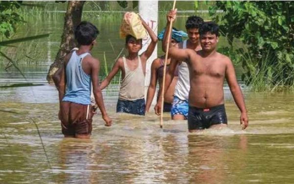
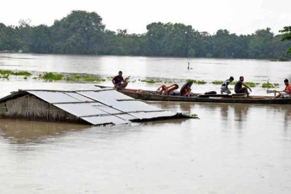
Bihar is currently grappling with one of the most destructive flood seasons in recent memory. With 18 districts severely affected, the devastating floods have claimed hundreds of lives and displaced over 7.2 lakh people. This annual crisis has inflicted widespread damage to homes, infrastructure, and agriculture, pushing vulnerable communities into deeper poverty. The floods have disrupted the lives of more than 1.4 crore people, leaving vast rural populations dependent on emergency aid and recovery support. In this dire situation, while government agencies have been leading the rescue and relief efforts, it is the contribution of civil society organizations, especially NGOs like ActionAid India, that has proven critical in bridging the gaps and providing life-saving assistance to affected populations.
The floods in Bihar this year have taken a heavy toll, with 304 reported deaths thus far, and the numbers continue to rise as the monsoon persists. The most severely affected areas include Araria, Sitamarhi, and West and East Champaran. In addition to human casualties, the floods have decimated livelihoods, submerging thousands of hectares of cropland and killing livestock, which are the backbone of rural Bihar’s economy. The floods have worsened food insecurity and limited access to clean drinking water, elevating the risk of disease outbreaks. Marginalized communities, such as Dalits, women, and small-scale farmers, have been hit particularly hard by this crisis, as their socioeconomic vulnerabilities are compounded by the lack of resources to recover from such catastrophic events.
ActionAid India, along with other NGOs like Oxfam India and the Bihar Inter-Agency Group (IAG), has been at the forefront of relief efforts in Bihar, working tirelessly to support affected communities. One of the key contributions of these organizations has been in establishing early warning systems that provide timely flood alerts to vulnerable populations. By leveraging community-based networks, ActionAid has developed mobile-based alert systems that inform residents of impending floods, allowing them to evacuate to safer areas, secure their belongings, and protect their families. These early warning systems have been critical in reducing casualties and ensuring that people in remote areas receive timely information about the evolving flood situation.
In the aftermath of the floods, ActionAid has been instrumental in delivering immediate relief to the hardest-hit communities. Through rapid needs assessments in districts like West Champaran, East Champaran, and Darbhanga, the organization has been able to prioritize the distribution of food, clean water, and shelter materials to the most vulnerable groups. For instance, ActionAid has provided emergency rations to over 2,500 Dalit and minority families in Sitamarhi, West Champaran, and East Champaran. Additionally, they have supported the government’s efforts to decontaminate water sources in East Champaran’s Dhaka block to prevent the spread of waterborne diseases, which are common in flood-hit areas.
At the same time, local NGOs and grassroots organizations have played a vital role in supplementing these efforts. They have been key in mobilizing rescue operations and distributing relief materials, particularly in hard-to-reach areas where government assistance is often delayed. Women-led self-help groups, empowered through government and NGO programs, have stepped up to identify vulnerable households and ensure that aid is distributed equitably. These groups have also been involved in setting up community kitchens that provide meals to displaced families, addressing the immediate food insecurity caused by the floods.
One of the most pressing needs during the floods has been providing shelter to displaced families. ActionAid, in coordination with local bodies and the state government, has helped set up temporary shelters using tarpaulin sheets, ropes, and bamboo poles, ensuring that people have a safe place to stay as they wait for the floodwaters to recede. The organization has also been advocating for long-term support to help affected families rebuild their homes once the floodwaters recede, particularly focusing on flood-resistant housing that can better withstand future disasters.
In addition to providing immediate relief, ActionAid has focused on long-term recovery and rehabilitation efforts in Bihar. The organization has initiated programs to support farmers who have lost their crops and livestock, providing them with seeds, livestock feed, and agricultural tools to help them restart their livelihoods. By addressing the economic devastation caused by the floods, these programs aim to build the resilience of rural communities, enabling them to recover more quickly and withstand future disasters.
ActionAid’s interventions have also extended to the health and sanitation needs of affected communities. In flood-hit areas, access to clean drinking water and proper sanitation is a major concern, as stagnant water becomes a breeding ground for diseases. ActionAid has provided hygiene kits, water purification tablets, and basic medical supplies to thousands of families, ensuring that they have the resources they need to stay healthy during the recovery process. Additionally, the organization has worked with local authorities to decontaminate water sources and build raised hand pumps that are less likely to be submerged during future floods.
While civil society organizations have been essential in addressing the immediate impacts of the floods, their role in long-term resilience-building cannot be overlooked. NGOs like ActionAid have been involved in creating infrastructure that is better suited to withstand floods, such as raised platforms for livestock, elevated public health centers, and flood-proof homes. These initiatives are vital in reducing the damage caused by floods and minimizing the need for emergency aid in the future.
Despite the significant contributions of NGOs and local bodies in flood management and relief in Bihar, the need for additional support remains urgent. The scale of the crisis demands greater coordination between government agencies, civil society, and the private sector to ensure that the most vulnerable populations receive the help they need. With the monsoon season still ongoing, the challenges of providing food, shelter, clean water, and medical care to displaced families will only intensify. As the situation unfolds, organizations like ActionAid will continue to play a crucial role in saving lives, restoring livelihoods, and building resilience in Bihar’s flood-affected communities.
The floods in Bihar have once again highlighted the critical role that civil society organizations play in disaster management. Through their community-based approach, rapid response capabilities, and focus on long-term resilience, NGOs like ActionAid India have become indispensable partners in managing the annual flood crisis in Bihar. However, to truly address the root causes of these disasters and mitigate their impact, greater collaboration, funding, and policy support will be necessary. Only by working together can we hope to build a future where Bihar’s communities are not just surviving the floods, but thriving in their aftermath.
Challenges Faced by Civil Society Organizations in Bihar
Despite their vital role in disaster management and community resilience, civil society organizations (CSOs) in Bihar encounter a myriad of challenges that hinder their effectiveness and sustainability. One of the most pressing issues is limited funding, particularly for smaller grassroots organizations. These organizations are often at the forefront of disaster response and recovery efforts, relying on donations, grants, and volunteer support. However, the funding landscape can be competitive and uneven, with larger NGOs often receiving the bulk of available resources. This disparity leaves smaller, community-based organizations struggling to maintain their operations, limiting their capacity to implement long-term programs that could help communities better prepare for and recover from floods. Without adequate financial resources, these organizations may find it challenging to attract and retain qualified staff, invest in necessary training, or expand their outreach and services, ultimately affecting the communities they serve.
Another significant challenge faced by CSOs in Bihar is the coordination between government agencies and non-governmental organizations. While collaboration is essential for effective disaster management, bureaucratic hurdles often complicate these relationships. Government agencies may have different priorities or lack the necessary frameworks to facilitate collaboration with NGOs, leading to fragmented efforts in addressing the needs of affected communities. In some cases, NGOs may find it difficult to navigate the regulatory environment, which can be cumbersome and slow, further delaying their response to disasters. This lack of synergy can result in duplicated efforts, wasted resources, and ultimately, a failure to address the urgent needs of those affected by floods. For CSOs to be truly effective in their roles, there must be a commitment from both governmental and non-governmental entities to foster open lines of communication, establish clear roles and responsibilities, and work collaboratively towards shared goals.
Moreover, while NGOs have demonstrated effectiveness in responding to floods through immediate relief efforts, there is an increasing recognition of the need for sustainable solutions that address the root causes of vulnerability. This includes advocating for significant investments in infrastructure development, such as improved drainage systems, flood barriers, and early warning systems, as well as the implementation of integrated river basin management strategies. The focus should not only be on short-term relief but also on building resilient communities that can withstand future disasters. NGOs play a crucial role in advocating for these changes, but their voices can often be drowned out by political interests and bureaucratic inertia. Therefore, it is imperative for CSOs to continue to engage with policymakers and advocate for comprehensive policy reforms that prioritize long-term strategies for flood risk reduction.
Ultimately, while civil society organizations in Bihar are making strides in addressing immediate needs in the wake of disasters, they must also navigate complex challenges that impede their effectiveness. A concerted effort is needed from all stakeholders—government agencies, NGOs, community members, and international organizations—to build a cohesive framework that supports sustainable development and disaster resilience. By overcoming funding limitations, improving coordination, and prioritizing long-term solutions, CSOs can strengthen their impact and contribute to a safer, more resilient future for communities vulnerable to flooding in Bihar.
Tides of Trouble: How Climate Disasters in Bihar Fuel Violence Against Women
In August 2017, devastating floods ravaged Bihar, leaving 3,000 square kilometers of the state submerged and forcing nearly 900,000 people from their homes. The floods claimed the lives of 815 people, while thousands of others sought refuge on roads, rail tracks, and rooftops. Amidst this humanitarian crisis, invisible from the aerial surveys conducted by Prime Minister Narendra Modi, was a different kind of devastation—an upsurge in violence and insecurity, particularly against women and girls.
Hema Devi, a teenager from Araria district, became one of the countless victims of this rising tide of gender-based violence. After the floods destroyed her village, she and her mother were forced to live in a makeshift tent along a national highway. In February 2018, months after the floods, a man offered her mother INR 5,000 (USD 67) in exchange for marrying Hema. Desperation and hope for a better future led her mother to agree. However, what followed was a nightmare—Hema was taken to Chandigarh, far from home, and suffered months of physical abuse before finally escaping. Her story mirrors the increased vulnerability of women and girls in the aftermath of disasters. In flood-affected areas like Bihar, extreme weather events exacerbate pre-existing social vulnerabilities, creating the perfect storm for violence against women.
The floods in Bihar, as in many other regions, not only destroy homes and livelihoods but also deepen the gender inequities that already plague these societies. In areas where men often migrate for work, women are left behind, burdened with raising families, managing households, and surviving amidst diminished income opportunities. Sons are seen as future breadwinners, while daughters are considered burdens, fueling discrimination and perpetuating harmful practices like dowry. This preference for male children intensifies during disasters, as families struggle to recover economically. Dowry demands, already a significant financial burden, further increase the vulnerability of young girls. Bina Devi from Katihar, a mother of three sons, explained the immense pressure on women to bear male children to secure their family’s financial future. After her husband’s death, her eldest son had to migrate at the age of 10 to support the family, a reality that shapes how families prioritize sons over daughters in the face of disaster-induced hardship.
Dowry concerns also leave families vulnerable to exploitation, with traffickers disguising themselves as prospective suitors offering to waive dowry in exchange for marrying young girls. Chandni, an 18-year-old from Katihar, recounted how her father was approached multiple times by such suitors, all from distant places, under the pretense of marrying her without dowry. Despite the financial pressures created by the floods, Chandni’s family has resisted these offers, suspecting them to be traffickers. Yet, for many families, the promise of avoiding dowry is too tempting to decline, especially when disasters like floods further erode their already meager earnings.
The threat of violence and exploitation extends beyond dowry and trafficking. Displacement caused by floods forces families into temporary shelters, where young women and girls are particularly vulnerable to harassment and sexual violence. In makeshift camps along highways and railway tracks, where tents are closely packed, privacy is scarce, and violence often follows. Activists working in Bihar report that in such camps, the risk of sexual harassment and violence is alarmingly high. Girls like Hema Devi, who once sought refuge in these camps, are left exposed to dangers far beyond the floods themselves. The vulnerability of women in disaster-prone areas like Bihar is multifaceted, shaped by the intersections of poverty, gender, and social marginalization.
Research increasingly highlights the link between climate change and gender-based violence. Studies conducted worldwide, from the Indian Ocean tsunami in Sri Lanka to floods in Pakistan’s Sindh region, have shown that women face increased risks of physical, emotional, and sexual violence in the aftermath of extreme weather events. In India, climate change exacerbates these risks, as recurring floods in Bihar create the conditions for a cycle of violence that disproportionately impacts women and girls. Yet, the data required to fully understand the extent of this problem remains scarce. Researchers have pointed out that the lack of sex-disaggregated data and indicators highlighting social inequities hinders efforts to examine the gendered impacts of disasters in India.
Despite the growing evidence of gender-based violence linked to disasters, government policies addressing climate change and disaster management remain largely gender-blind. A recent parliamentary report on flooding made no mention of women, and many state action plans on climate change fail to address gender at all. Even when policies do consider gender, they often treat women as a monolithic category, ignoring how other forms of marginalization, like caste, intersect with gender to compound vulnerabilities. Caste continues to play a significant role in shaping power dynamics in India, and climate-related disasters are only making these power imbalances more pronounced.
For women like Hema, Bina, and Chandni, the challenges posed by floods go far beyond the physical destruction of homes and livelihoods. These disasters magnify the social inequalities that women already face, deepening the cycles of violence, discrimination, and exploitation. Without targeted research, policies, and interventions that recognize the complex ways in which climate change affects women, especially those from marginalized communities, these cycles will continue to perpetuate, leaving women to bear the brunt of an increasingly unstable climate.
A Way Forward: Strengthening Civil Society’s Role
For a more effective flood management system in Bihar, it is essential to strengthen the collaboration between the government, civil society, and local communities. Public-private partnerships, capacity-building initiatives, and enhanced funding mechanisms for NGOs can empower these organizations to extend their reach and impact.
Civil society has already demonstrated its ability to mobilize resources quickly, foster community participation, and provide long-term rehabilitation support. With improved coordination, resource allocation, and infrastructure development, their efforts can be amplified to create a more resilient Bihar.
The role of civil society in managing the floods of Bihar cannot be overstated. From early warning systems to relief distribution and long-term recovery, NGOs and local bodies have become the backbone of the state’s flood management efforts. By working hand in hand with the government and the affected communities, civil society continues to be a crucial force in mitigating the impact of floods and ensuring the resilience of Bihar’s most vulnerable populations.
Innovative Solutions for Flood-Resilient Housing Exploration of new technologies and materials being used to construct flood-resistant homes
Sapna Kumari holds a master’s degree in disaster management from Tata Institute of Social Sciences. As a seasoned disaster manager, she is currently engaged in the recovery efforts for the Balasore train disaster. She works closely with the State Disaster Management Authority of Bihar to enhance resilience and recovery strategies
This article contains an in-depth analysis of modular and prefabricated housing as a flood resilience solution, exploring how these structures can be quickly assembled in vulnerable areas. It highlights their potential to offer durable, flood-resistant designs while being cost-effective and adaptable to various terrains. By focusing on the benefits of using prefabrication in disaster-prone regions, the article underscores the importance of innovative housing solutions in enhancing community resilience and recovery efforts.
Introduction
As climate change accelerates, the frequency and intensity of flooding events are increasing, posing significant challenges to housing stability, community resilience, and human safety. Traditional construction methods often fall short in protecting homes against the impacts of flooding. However, innovative technologies and materials are emerging that promise to enhance flood resilience in housing. This article explores some of the groundbreaking solutions being adopted in flood-prone areas worldwide.
Innovative Solutions for Flood-Resilient Housing: Exploring New
Technologies and Materials
As climate change continues to reshape our world, one of the most alarming and frequent consequences is the rise of severe flooding events. Coastal regions, river basins, and even urban environments are grappling with unprecedented levels of flooding, which threatens homes, livelihoods, and entire communities. For many, the question is no longer whether they will face floods, but how often and how devastating these floods will be. In this new reality, the need for innovative, flood-resilient housing solutions has never been more urgent.
The idea of building flood-resistant homes is not entirely new. Coastal communities around the world have long employed techniques like elevating homes or using materials that withstand moisture. However, as flood risks grow in scale and complexity, architects, engineers, and material scientists are pushing the boundaries of what is possible. Today’s flood-resilient housing is a blend of futuristic technology and sustainable, time-tested practices, offering not just protection but a reimagined way of living in harmony with water.
Building Up, Not Out
One of the most straightforward methods to mitigate flood damage is to elevate homes above expected water levels. Historically, this meant stilt houses in riverine or coastal areas, where communities adapted to their water-rich environments. But modern elevated housing goes beyond simple stilt structures. Today, architects are elevating entire homes on sleek platforms that incorporate high-tech materials capable of withstanding both the weight of the home and the pressure of floodwaters.
In urban areas, where space is at a premium, these elevated designs take on new forms. Some homes are being designed with flexible, floating foundations that rise and fall with water levels. Rather than resisting the water, these homes embrace its ebb and flow. This concept, known as amphibious architecture, is gaining traction in flood-prone cities like New Orleans and Amsterdam, where the combination of beautiful design and flood resilience is becoming a priority for homeowners.
A New Generation of Materials
The choice of materials has always been critical in flood-prone construction. In the past, wood, brick, and traditional cement were the go-to choices for building homes. But with the intensifying floods, these materials often succumb to water damage, mold, and rot. Enter the new generation of flood-resistant materials designed not just to endure water but to thrive in wet environments.
Waterproof concrete is one such innovation, a seemingly magical material that can repel water while self-healing small cracks when exposed to moisture. This cutting-edge technology ensures that homes built with waterproof concrete are not only resistant to immediate flood damage but also remain strong for years, avoiding the costly repairs that come with traditional building materials. Another intriguing advancement is the use of engineered wood products, which combine the aesthetic warmth of timber with enhanced moisture resistance, ensuring that homes can remain both stylish and resilient in the face of flooding.
But perhaps the most exciting materials lie in the realm of composites. By blending natural fibers with polymers, scientists have created lightweight yet durable materials that are resistant to both moisture and environmental degradation. These composite materials are already being used in bridges, and their introduction into housing opens the door for flood-resistant homes that are not only strong but also environmentally friendly.
Rethinking How We Build Homes
Beyond the materials and designs, the entire process of homebuilding is evolving in response to the need for flood resilience. Modular and prefabricated homes, once thought of as temporary or low-quality housing, are now leading the charge in creating durable, flood-resistant homes that can be constructed quickly and affordably.
These homes are built off-site in climate-controlled environments, ensuring that each component is crafted with precision and using the best flood-resistant materials available. Once transported to the building site, they are assembled in a fraction of the time it would take to build a traditional home. What’s more, these modular designs are fully customizable, allowing homeowners in flood-prone regions to include features like elevated foundations or water-tight seals, depending on their specific needs.
The result is a revolution in homebuilding, where flood-resilient homes are not only more affordable but can also be tailored to the unique demands of local environments. In regions facing annual floods, prefabricated homes can be quickly deployed to replace destroyed housing, providing families with secure, long-term shelter in record time.
Smart Homes for Flood Protection
As we move further into the digital age, smart technologies are playing an increasingly important role in flood-resilient housing. Imagine a home that can not only detect rising water levels but also take action to protect itself. This is no longer a fantasy but a reality in some of the most forward-thinking communities around the world.
Homes equipped with flood sensors can alert homeowners and emergency services the moment floodwaters begin to rise, giving people critical time to evacuate or take protective measures. Automated flood barriers can deploy around homes, creating a protective shield that keeps floodwaters at bay. Even the interiors of these smart homes are designed with flood resilience in mind—backup power systems ensure that essential services like lighting and refrigeration continue to function even in the midst of a storm.
The integration of smart home technology into flood-resilient housing not only offers peace of mind but also contributes to a holistic approach to disaster preparedness. These homes become part of a larger network of flood management, where real-time data on water levels, storm surges, and rainfall can be used to protect entire communities.
Designing for the Future
Ultimately, the solutions to flood-resilient housing are not just technical but deeply intertwined with how we plan and design our communities. In many regions, urban planners are working closely with architects to create flood-resistant neighborhoods, where housing design is complemented by larger, community-wide flood management systems.
Green roofs, for example, are being incorporated into homes as a way to absorb rainfall and reduce runoff. These lush, plant-covered rooftops not only manage water but also help cool homes and reduce energy consumption, making them a perfect blend of sustainability and resilience. Permeable surfaces, such as porous concrete and permeable pavers, allow rainwater to filter into the ground rather than overwhelming drainage systems, further mitigating flood risks.
But perhaps the most powerful tool for creating flood-resilient housing is collaboration. Communities around the world are working together to share knowledge, experiences, and resources, ensuring that flood-resilient housing is not just for the wealthy but accessible to all. Governments are partnering with non-profits, engineering firms, and local residents to create housing solutions that are affordable, sustainable, and, above all, safe from floods.
Here are some solutions for flood resistant homes:
Elevated Structures
One of the most effective strategies for flood-resistant housing is the elevation of structures. By building homes on stilts, raised platforms, or piers, these elevated designs lift homes above potential floodwaters, significantly reducing the risk of water damage. This method has long been a staple in regions prone to river flooding and storm surges, from the coastal villages of Southeast Asia to the floodplains of the Mississippi River in the United States. However, with the growing threat of climate change and increasingly severe weather events, the practice of elevating homes has become not just a cultural adaptation but a critical necessity for flood-prone communities across the globe.
Recent advancements in engineering and design have brought about a transformation in the way these elevated homes are constructed. No longer do elevated structures need to be purely functional and bare; they are now seen as opportunities for aesthetic and architectural innovation. Architects are designing elevated homes that blend seamlessly with their surroundings, creating homes that stand out for their beauty as much as their resilience. In flood-prone urban areas like New Orleans or Jakarta, elevated homes are now being incorporated into cityscapes, balancing safety with style. These elevated designs are not just practical—they also serve as visual reminders of how cities can adapt to the realities of a changing climate.
In addition to the architectural advancements, techniques such as the use of geo-synthetic materials in foundation support have greatly enhanced the stability and longevity of these elevated structures. These high-tech materials provide extra reinforcement, allowing foundations to better withstand the pressures of shifting floodwaters and erosion. As floods become more frequent and severe due to climate change, this kind of technological innovation is crucial. Homes that incorporate these advanced materials are better equipped to endure repeated flood events, offering not just immediate protection but long-term resilience. In disaster-prone areas, the combination of elevated designs and modern materials is paving the way for safer, more sustainable living in an era of unpredictable weather.
Flood-Resistant Materials
As the threat of floods intensifies globally, particularly in coastal and low-lying areas, the need for innovative, flood-resilient housing has never been greater. Beyond traditional methods such as elevating homes, a new frontier of materials is emerging, designed specifically to withstand the unique challenges posed by floodwaters. These advanced materials offer not only enhanced protection during floods but also contribute to the long-term durability and sustainability of homes in vulnerable areas. Architects, engineers, and builders are increasingly exploring these materials to redefine what flood-resilient housing looks like in the face of more frequent and severe weather events.
One of the most revolutionary materials being utilized in flood-resilient construction is waterproof concrete. While concrete has long been a standard in construction, it has traditionally been vulnerable to water damage, especially in flood-prone areas where moisture seeps into the material, weakening its structure over time. Waterproof concrete changes the game entirely. This specialized concrete incorporates hydrophobic agents that actively repel water, preventing it from penetrating the surface and causing internal damage. In addition to its water-repelling capabilities, this material also boasts self-healing properties. When cracks begin to form—whether from normal wear and tear or during a flood—the concrete reacts to water exposure by sealing itself, effectively preventing further damage. This innovative material not only reduces the need for frequent repairs but also enhances the overall resilience of flood-affected structures, ensuring that they remain safe and habitable even after a disaster.
In addition to waterproof concrete, resilient wood products are also making waves in the field of flood-resistant housing. Traditionally, wood has been seen as a vulnerable material in flood conditions, as prolonged exposure to moisture can lead to warping, rotting, and mold growth. However, engineered wood products, such as Cross-Laminated Timber (CLT) and laminated veneer lumber (LVL), are changing this perception. These materials are specially designed to withstand the stresses of a flood. By layering timber in opposing directions, CLT and LVL offer remarkable durability and flexibility, even in high-moisture environments. They maintain their structural integrity when exposed to water, and treatments can be applied to enhance their resistance to moisture even further. These advancements in wood engineering are significant because they allow builders to maintain the natural aesthetic and sustainability of wood construction while ensuring the material can withstand the harsh conditions that come with flooding.
Composite materials represent another exciting innovation in flood-resilient construction. These materials, which combine natural fibers with polymers, offer a unique blend of strength, lightweight properties, and resistance to water damage. Composite materials are particularly advantageous in flood-prone areas because they resist rot and degradation, even when submerged for extended periods. Additionally, their lightweight nature allows for more flexibility in design and transportation, making them ideal for both pre-fabricated and traditional construction methods. In places where frequent flooding occurs, such as delta regions or tropical climates, composite materials can be used in everything from foundation elements to external cladding, providing an added layer of protection against the elements.
These advancements in materials science are more than just technical achievements; they represent a shift in how we approach building homes in the age of climate change. By incorporating materials like waterproof concrete, engineered wood, and composite fibers, builders are not only protecting homes from immediate flood damage but also ensuring that these homes remain resilient over time. As disasters become more frequent and destructive, the ability to quickly rebuild and recover is crucial, and these innovative materials are making it easier to do just that. In many ways, they are a testament to human ingenuity and our ability to adapt to the challenges posed by a rapidly changing environment.
In flood-prone areas around the world, these materials are already being put to use, providing a glimpse into the future of resilient housing. From coastal cities like New York and Miami to rural villages in Bangladesh and the Philippines, homes built with these cutting-edge materials are standing strong against the forces of nature. As we look to the future, the integration of these technologies will likely become the new standard in flood-resilient design, helping communities not only survive but thrive in the face of disasters.
Modular and
Prefabricated Housing
Modular and prefabricated housing has gained traction as an innovative solution for flood resilience. These structures are built off-site and assembled on location, allowing for greater control over construction quality and materials. Key benefits include:- Rapid Deployment: In disaster-prone areas, modular homes can be quickly deployed to provide immediate shelter after a flood event. Their prefabricated nature ensures that they can be produced in bulk and installed rapidly.
- Customizable Designs: Modular homes can be customized to meet specific flood resilience requirements. Designers can incorporate features such as elevated foundations and flood-resistant materials based on local risks.
- Cost-Effectiveness: Prefabricated construction often reduces labor costs and construction time, making it a more affordable option for flood-prone regions.
Green Roofs and
Sustainable Design
Incorporating green roofs into flood-resilient housing provides multiple benefits. Green roofs not only manage stormwater runoff but also enhance insulation, reduce urban heat, and improve air quality. By absorbing rainfall, these roofs help mitigate flooding and can reduce the volume of water that needs to be managed by stormwater systems.
Additionally, sustainable design principles are increasingly being integrated into flood-resilient housing. This includes:
Permeable Surfaces: Using permeable materials for driveways and walkways allows rainwater to infiltrate the ground rather than accumulate and contribute to flooding.
Rainwater Harvesting Systems: These systems capture and store rainwater for reuse, reducing demand on municipal water systems and helping manage stormwater runoff.
Smart Technologies
The integration of smart technologies in flood-resilient housing is revolutionizing how we approach flood management. Smart homes equipped with sensors and monitoring systems can provide real-time data on weather conditions, water levels, and potential flood risks. - Flood Detection Sensors: These sensors can detect rising water levels and send alerts to homeowners, allowing for timely evacuations or protective measures.
- Automated Flood Barriers: Advanced technologies now allow for the installation of automated flood barriers that deploy when water levels rise, providing an additional layer of protection.
- Smart Home Systems: Integrating smart home technology can also enhance energy efficiency and emergency preparedness. For instance, homes can be equipped with backup power systems that activate during a flood, ensuring residents have access to necessary utilities.
Community-Centric
Approaches
Innovative flood-resilient housing extends beyond individual homes to encompass entire communities. Collaborative efforts that involve local governments, organizations, and residents can lead to comprehensive flood management strategies. - Community Planning: Urban planning that prioritizes green spaces and water management can create buffer zones that absorb excess water and reduce flooding impacts.
- Participatory Design: Engaging communities in the design process ensures that housing solutions are tailored to local needs and cultural contexts.
- Public Awareness and Training: Education initiatives that promote awareness about flood risks and preparedness can empower communities to take proactive measures in safeguarding their homes.
Conclusion
As the world faces the escalating impacts of climate change, the way we build homes must change as well. Flood-resilient housing is no longer a luxury but a necessity in many parts of the world. By embracing innovative materials, modular construction, smart technologies, and sustainable design principles, we can create homes that not only withstand floods but offer a better quality of life for those who live in them.
Innovative solutions for flood-resilient housing are critical in addressing the challenges posed by increasing flooding events. From elevated structures and advanced materials to smart technologies and community-centric approaches, these strategies promise to enhance the resilience of homes and communities alike. As we continue to confront the realities of climate change, investing in flood-resilient housing will not only protect lives and property but also contribute to the sustainability and livability of our urban environments.
The future of housing lies in resilience, and with the right solutions, we can ensure that communities are not just surviving but thriving in a world where water is both a resource and a challenge. Flood-resilient housing represents a bold step forward, a testament to human ingenuity in the face of nature’s greatest forces.
By embracing innovation and collaboration, we can build a future where communities are better equipped to withstand and recover from flooding, ensuring a safer, more resilient world for generations to come.
Flood Management in Kerala: A Model for Disaster Resilience
Appu KG is a dedicated disaster management professional who has earned a Master’s degree in Disaster Management from the prestigious Tata Institute of Social Sciences (TISS). With a strong academic foundation and a wealth of practical experience, Appu has honed his expertise in disaster risk reduction, emergency
response, and resilience-building strategies. His fieldwork spans across diverse regions, where he has
actively contributed to disaster preparedness and recovery efforts, showcasing his commitment to safeguarding vulnerable communities. Appu’s comprehensive understanding of disaster dynamics and his hands-on experience make him a valuable asset in the field of disaster management.This article explores Kerala’s evolution into a global model for flood management and disaster resilience, particularly after the devastating floods of 2018. It highlights the state’s strategic approach, which includes the use of modern technology such as real-time flood monitoring systems, early warning mechanisms, and drones for damage assessment. Community participation, policy reforms, and environmental conservation efforts have also played crucial roles in building long-term resilience. By examining these initiatives, the article showcases how Kerala has successfully transformed its flood management framework to better protect lives, livelihoods, and the environment.
Floods are one of the most severe and frequent natural disasters globally, often leading to devastating consequences for human lives, property, and the environment. Kerala, a southern Indian state, has been particularly vulnerable to floods due to its geographical location, dense river network, and tropical climate. In recent years, Kerala has experienced severe floods, with the 2018 and 2019 monsoon floods leaving behind a trail of destruction. However, these calamities also prompted a significant shift in how Kerala approached flood management, resulting in a more disaster-resilient model that has gained international recognition.
Kerala’s model for flood management has evolved over time, integrating technology, policy reforms, community participation, and environmental conservation. This article examines the state’s transformation from a flood-prone region to a global example of disaster resilience. We will explore how Kerala has effectively responded to floods, improved preparedness, and developed sustainable strategies to manage the long-term impact of such natural disasters.
Geographical and Climatic Vulnerability of Kerala
Kerala’s geographical position, nestled between the Arabian Sea on the west and the Western Ghats on the east, makes it particularly prone to floods. The Western Ghats, a mountain range that runs parallel to the coast, receive heavy rainfall during the monsoon season, leading to high water levels in Kerala’s numerous rivers and lakes. This topographical structure, coupled with a tropical monsoon climate, makes Kerala highly susceptible to flooding, especially during the southwest monsoon from June to September.
The state’s unique landscape also includes a network of rivers, lakes, and backwaters, which further increase the risk of floods. With 44 rivers crisscrossing the state, the risk of riverine flooding is high during intense monsoon rains. Several regions, such as Kuttanad in Alappuzha district, lie below sea level, making them particularly vulnerable to floods.
However, while Kerala’s topography and climate contribute to its flood vulnerability, human activities such as unregulated construction, deforestation, and poor urban planning have exacerbated the impact of floods. The rapid expansion of urban areas, often without adequate drainage infrastructure, has led to increased waterlogging during heavy rains, further intensifying the problem.
The 2018 Kerala Floods: A Disaster That Changed Everything
The 2018 floods in Kerala were among the worst in the state’s history, marking a turning point in its approach to disaster management. Unusually high monsoon rainfall, coupled with the mismanagement of dam water releases, led to catastrophic flooding across most of the state. Heavy rains caused several rivers, including the Periyar and Pamba, to overflow, submerging large areas and affecting almost all districts of Kerala.
More than 400 people lost their lives, and over a million residents were displaced from their homes. The floods caused widespread destruction of infrastructure, homes, agricultural land, and public utilities, with the economic loss estimated at around Rs 40,000 crores (approximately $5.5 billion). Entire towns and villages were inundated, with essential services like transportation, healthcare, and education coming to a standstill.
The disaster highlighted several critical gaps in Kerala’s flood management system:- Inadequate Early Warning Systems: There was a lack of accurate early warning systems that could provide timely information about impending floods.
- Mismanagement of Dam Releases: The release of water from dams during peak rainfall periods contributed significantly to the floods.
- Unregulated Urbanization: Rapid urban growth, without sufficient planning for drainage and flood prevention, exacerbated the impact of the floods.
Despite the devastation, the 2018 floods served as a wake-up call for Kerala. The disaster acted as a catalyst for change, leading to a comprehensive reassessment of the state’s flood management policies and practices. - Technology-Driven Solutions: Modernizing Flood Management
One of the significant shifts in Kerala’s flood management strategy has been the adoption of modern technology to improve flood forecasting, monitoring, and early warning systems. The use of technology has significantly enhanced the state’s ability to predict and respond to floods, minimizing the damage and loss of life.
Real-Time Flood
Monitoring Systems
Post-2018, Kerala has implemented real-time flood monitoring systems that utilize satellite data, Geographic Information System (GIS) mapping, and hydrological models. These systems allow authorities to monitor water levels in rivers, lakes, and dams in real-time, providing early warnings about potential flooding.
The Kerala State Disaster Management Authority (KSDMA) has worked closely with organizations like the Indian Space Research Organisation (ISRO) to develop accurate models that can predict rainfall patterns and river flows. These models use data from weather satellites and ground-based sensors to generate real-time information on water levels and potential flood risks. This data is crucial for decision-making during the monsoon season, allowing local authorities to take preventive measures such as issuing evacuation orders and preparing emergency shelters.
Early Warning Systems
The introduction of early warning systems has been a game-changer in Kerala’s flood preparedness. These systems provide timely alerts to local authorities and the public about the possibility of floods. The KSDMA issues alerts based on real-time data, which are disseminated through multiple channels, including SMS, social media, and radio broadcasts.
Early warning systems are particularly important for communities living in flood-prone areas, as they allow residents to evacuate in advance and take necessary precautions to protect their homes and belongings. The ability to receive real-time updates has significantly improved Kerala’s disaster preparedness, reducing the impact of floods on human lives.
Drone Technology for Post-Flood Assessment
Drones have become an essential tool in post-flood assessment and rescue operations in Kerala. After a flood, drones are deployed to capture aerial footage of affected areas, providing authorities with a clear view of the damage. This technology is particularly useful in areas that are difficult to access by road due to waterlogging or collapsed infrastructure.
The use of drones allows for quicker and more accurate assessments of the damage, enabling authorities to prioritize rescue and relief operations. Drones are also used to identify areas where relief supplies, such as food and medical aid, are most needed, ensuring that resources are distributed efficiently.
Community Involvement: The Backbone of Kerala’s Flood Resilience
While technology has played a crucial role in Kerala’s flood management efforts, the involvement of local communities has been equally important. Kerala’s disaster resilience model relies heavily on community-driven initiatives, where local residents play an active role in flood preparedness, response, and recovery.
Community Emergency Response Teams (CERTs)
One of the most successful initiatives in Kerala’s flood management strategy has been the formation of Community Emergency Response Teams (CERTs). These teams are made up of local volunteers who are trained in first aid, rescue operations, and disaster management. CERTs are the first responders during floods, helping to evacuate residents, provide medical assistance, and coordinate relief efforts.
The success of CERTs lies in their ability to mobilize quickly and respond to emergencies before external help arrives. These teams are familiar with the local terrain and are often better positioned to provide immediate assistance to flood-affected communities. Training programs are regularly conducted to equip CERT members with the necessary skills to handle various disaster scenarios, ensuring that they are prepared for any eventuality.
Role of Fishermen in Rescue Operations
Kerala’s fishermen emerged as unsung heroes during the 2018 floods, using their boats to rescue thousands of people stranded in flooded areas. Their knowledge of the local waters, coupled with their quick response, made them invaluable assets in the state’s disaster response efforts.
Since then, fishermen have been formally integrated into Kerala’s flood management plans. Many have received additional training in disaster response and are now part of the state’s official rescue teams. Their involvement highlights the importance of utilizing local knowledge and resources in disaster management.
Public Awareness Campaigns
Raising public awareness about flood preparedness is a critical component of Kerala’s disaster management strategy. The government, in collaboration with local organizations and schools, has launched extensive awareness campaigns to educate residents about flood risks and safety measures. These campaigns focus on teaching people how to protect their homes, what to do during a flood, and how to access emergency services.
One of the most effective ways Kerala has promoted public awareness is through mock drills. These drills simulate flood scenarios and teach residents how to respond in an emergency. They also provide an opportunity for CERTs and local authorities to test their preparedness and identify areas for improvement.
Policy Reforms:
Strengthening Flood
Management Frameworks
In the aftermath of the 2018 floods, Kerala’s government recognized the need for stronger policy frameworks to manage floods and other natural disasters. Several key reforms have been implemented to ensure that the state is better prepared for future floods.
Integrated Water
Resources Management (IWRM)
One of the most significant reforms has been the adoption of Integrated Water Resources Management (IWRM), a comprehensive approach to managing Kerala’s water resources. IWRM aims to coordinate the management of rivers, dams, reservoirs, and other water bodies to prevent sudden releases of water that could contribute to flooding.
Under IWRM, dam authorities, disaster management agencies, and local governments work together to regulate water levels in reservoirs and release water in a controlled manner. This prevents the sudden surge in river levels that often leads to floods during the monsoon season.
Revised Urban Planning and Building Codes
The rapid expansion of urban areas in Kerala has contributed to the state’s flood vulnerability. In many cities and towns, construction has taken place in flood-prone areas without adequate planning for drainage and flood prevention. To address this issue, Kerala has introduced new urban planning regulations that restrict construction in floodplains and low-lying areas.
The government has also revised building codes to ensure that new constructions are flood-resistant. For example, buildings in flood-prone areas must be constructed on raised platforms to minimize water damage. Additionally, the use of permeable materials in construction is encouraged to reduce runoff and allow rainwater to seep into the ground.
Flood-Resistant
Infrastructure Development
Another critical policy reform has been the investment in flood-resistant infrastructure. The government has prioritized the construction of stronger embankments, improved drainage systems, and flood-resistant housing in vulnerable areas. These infrastructure projects are designed to mitigate the impact of floods and ensure that essential services, such as transportation and healthcare, are not disrupted during a disaster.
Post-Flood Recovery and Rehabilitation
Once the immediate crisis of a flood has been managed, the focus shifts to recovery and rehabilitation. Kerala has developed a comprehensive approach to post-flood recovery, with a strong emphasis on rebuilding in a way that enhances future resilience.
Housing and Infrastructure
Reconstruction
The destruction of homes and infrastructure is one of the most visible consequences of floods. In the aftermath of a flood, the government provides financial assistance to affected families to rebuild their homes. In many cases, houses are rebuilt with stronger, flood-resistant materials to prevent future damage.
The reconstruction of public infrastructure, such as roads, bridges, and schools, is also a priority. The government has adopted a “build back better” approach, ensuring that newly constructed infrastructure is more resilient to future floods.
Livelihood Restoration
Floods often have a devastating impact on livelihoods, particularly in rural areas where agriculture is the primary source of income. To support flood-affected communities, Kerala has implemented several livelihood restoration programs. These programs provide financial assistance, job creation opportunities, and training in alternative livelihoods to help people recover economically.
For example, farmers whose crops were destroyed by floods receive compensation and access to seeds and equipment to replant their fields. Fishermen whose boats were damaged receive assistance to repair or replace their equipment. These efforts are essential for ensuring that communities can recover quickly and sustainably after a disaster.
Environmental Conservation: A Long-Term Flood Mitigation Strategy
One of the key lessons Kerala has learned from its flood experiences is the importance of preserving and restoring natural ecosystems that act as flood buffers. Wetlands, forests, and mangroves play a crucial role in absorbing excess rainwater, stabilizing soil, and preventing runoff into rivers.
Wetland and Mangrove Restoration
Wetlands and mangroves are natural flood control systems that absorb large amounts of water and release it gradually. However, many of these ecosystems have been degraded or destroyed due to human activities such as construction and deforestation. Recognizing their importance, Kerala has launched several projects to restore wetlands and mangroves in flood-prone areas.
Restoring these ecosystems not only helps prevent floods but also promotes biodiversity and supports local communities that rely on wetlands and mangroves for their livelihoods.
Afforestation Programs
Forests act as natural barriers against floods by absorbing rainwater, stabilizing soil, and reducing runoff. Deforestation, particularly in the Western Ghats, has contributed to soil erosion and increased flood risk in Kerala. To combat this, the state’s forest department has launched afforestation programs aimed at planting trees in flood-prone areas, especially along riverbanks and in hilly regions.
These programs not only reduce flood risk but also help mitigate the effects of climate change, which is expected to increase the frequency and intensity of floods in the future.
The Role of International Collaboration
Kerala’s flood management model has benefited significantly from international collaboration. Several global organizations, including the United Nations Development Programme (UNDP) and the World Bank, have provided financial and technical support to Kerala’s disaster management programs. These collaborations have allowed Kerala to access advanced technologies, best practices, and expertise from countries that have faced similar flood challenges.
Learning from the
Netherlands
One of the most significant collaborations has been with the Netherlands, a country known for its expertise in flood management. The Dutch government has provided technical assistance to Kerala in areas such as river management, flood-resistant infrastructure, and urban planning. The Netherlands’ expertise has helped Kerala develop more sustainable and effective flood management strategies.
Conclusion
Kerala’s transformation into a model for flood management and disaster resilience is a testament to the state’s ability to learn from past experiences and adapt to new challenges. Through a combination of technology, community involvement, policy reforms, and environmental conservation, Kerala has developed a comprehensive approach to flood management that significantly reduces the impact of floods.
While the state’s geographical location and climate make it inherently vulnerable to floods, Kerala’s proactive strategies have helped save lives, protect livelihoods, and build a more resilient society. As climate change continues to increase the frequency and intensity of natural disasters, Kerala’s flood management model serves as an inspiration for other regions facing similar challenges.
By combining modern technology with traditional knowledge and local community involvement, Kerala has shown that disaster resilience is not only achievable but essential in the face of growing environmental threats.
Assam Floods: Examining the regular flooding in Assam, Challenges and how local communities adapt
Eddie L. Ralte is a seasoned disaster management professional and a Cyber and Strategic Risk Consultant at Deloitte, specializing in resilience and risk mitigation strategies. With extensive fieldwork experience and a track record of successful research, he has significantly contributed to enhancing disaster preparedness and response frameworks.
This article contains an in-depth examination of the persistent flooding challenges faced by Assam, India, and the adaptive strategies employed by local communities in response to these disasters. It highlights the geographical and climatic factors contributing to frequent floods, the inadequacies of existing flood management infrastructure, and the impacts on agriculture and livelihoods. Additionally, it discusses the resilience of communities, including the construction of stilt houses and the use of flood-resistant crops, as well as the crucial role of traditional knowledge and women in recovery efforts. The article emphasizes the need for comprehensive solutions, including infrastructure improvements, wetland restoration, and the promotion of climate-resilient agriculture, to enhance Assam’s resilience to future floods.
Assam, located in the northeastern region of India, is no stranger to devastating floods. With its rich biodiversity and rivers like the Brahmaputra flowing through, the state faces recurrent flooding, especially during the monsoon season. Every year, these floods wreak havoc on the lives and livelihoods of millions of people, affecting agriculture, infrastructure, and ecosystems.
The Challenges: Why Assam Faces Regular Flooding
Assam’s geography and climatic conditions make it prone to seasonal floods. The Brahmaputra River, one of the largest rivers in the world, carries a massive amount of water and sediment, often resulting in riverbank erosion and flash floods. Additionally, deforestation in the hills and catchment areas, improper drainage systems, and siltation of rivers have further exacerbated the situation. Climate change has also played a role, intensifying rainfall patterns and causing extreme weather events that increase flood frequency.
Another major concern is Assam’s aging and insufficient flood management infrastructure. Embankments, which are meant to protect against rising water levels, often breach due to poor maintenance, further aggravating the situation. Many flood-prone areas lack effective early warning systems and resilient infrastructure to cope with recurrent disasters.
Community Adaptation: The Resilience of Assam’s People
Despite the regularity of floods, the local communities in Assam have developed a range of adaptive strategies to survive these recurring disasters. For generations, residents have built stilt houses, known as chang ghar, to stay above rising water levels. Additionally, in rural areas, many have learned to diversify their agricultural practices by adopting flood-resistant crops, ensuring that their livelihoods are not entirely dependent on flood-vulnerable land.
Another important community response comes in the form of traditional knowledge-sharing systems. Villages often work together to prepare for floods, raising livestock and storing essential food supplies in elevated areas. Local leaders and grassroots organizations play a critical role in ensuring swift evacuations, setting up community shelters, and coordinating relief efforts.
The role of women in flood management and recovery is also notable. Often, women are the primary caregivers and play a crucial part in food management, healthcare, and safeguarding resources during floods. Women-led self-help groups (SHGs) in flood-affected areas have been instrumental in rebuilding efforts, providing microfinance support and emotional resilience to affected families.
Assam’s long history of flooding has shaped the lives and livelihoods of its communities, compelling them to develop a range of adaptive strategies. Despite living with these natural disasters for centuries, the recent shifts in flood patterns—marked by increased intensity and unpredictability—have challenged traditional methods of adaptation.
Local communities have historically relied on the construction of embankments to safeguard their homes and agricultural land. However, these structures have proven insufficient against the increasingly severe and sudden floods, particularly those caused by cloudbursts and extreme rainfall upstream. As a result, many residents are now more vulnerable, grappling with a sense of false security that embankments can provide complete protection.
In response to the changing nature of flooding, communities have begun to innovate their approaches. Farmers are adapting their planting schedules, shifting to flood-resistant crops or varieties that can withstand short-term inundation. Additionally, there is a growing emphasis on traditional knowledge systems that inform land-use practices, helping to mitigate the impacts of floods.
Relief and recovery strategies have also evolved, with many families establishing local networks for sharing resources and information during flooding events. These networks facilitate timely responses and aid distribution, enhancing resilience in the face of adversity.
However, as flooding frequency increases and new areas become affected, the need for comprehensive reassessment of flood management strategies is evident. There is a pressing need for integrating climate resilience into community planning, which includes improving the design and materials of embankments and investing in sustainable land-use practices.
Local communities’ adaptability is crucial, yet it must be bolstered by external support and effective policy measures. Enhancing awareness about the limitations of existing infrastructure and promoting a culture of preparedness are essential steps in ensuring the safety and livelihoods of those living in flood-prone areas of Assam.
Government and NGO Interventions: What Has Been Done?
Both the Assam government and various non-governmental organizations (NGOs) have launched multiple interventions to address the flood crisis. The National Disaster Management Authority (NDMA) and Assam State Disaster Management Authority (ASDMA) work together to implement flood management plans, including embankment construction, river dredging, and flood forecasting systems.
NGOs such as ActionAid India and Save the Children have been active in conducting flood relief operations, distributing emergency supplies, and promoting disaster preparedness. They have also partnered with local communities to enhance flood-resilient farming practices, build stronger community shelters, and improve access to safe drinking water during floods.
However, challenges remain. Delays in relief distribution, insufficient funding for flood mitigation infrastructure, and gaps in policy implementation continue to leave many vulnerable communities at risk.
The Magnitude of
Flooding: A Persistent Challenge
The flood problem in Assam is unlike that of any other state in India, both in terms of the scale and duration of inundation and the severity of erosion. More than 50 tributaries feed the Brahmaputra and Barak rivers, making the region susceptible to frequent floods during the monsoon season. Floods affect an average of 9.31 lakh hectares annually, causing widespread damage to agriculture, property, and infrastructure. The floods of 1998 and 2004 stand out as particularly disastrous, with losses reaching Rs. 500 crores and Rs. 771 crores, respectively.
Moreover, flash floods, triggered by cloudbursts in neighbouring states like Arunachal Pradesh and Meghalaya, often compound the situation. These sudden, high-magnitude floods have wreaked havoc on large areas, sweeping away homes and claiming lives. For example, the flash floods of 2011, caused by a cloudburst in Arunachal Pradesh, led to extensive damage as the rivers Gainadi and Jiadhal overflowed.
The Challenge of
Riverbank Erosion
Alongside flooding, riverbank erosion has emerged as a significant threat in Assam. The Brahmaputra and Barak rivers, along with their tributaries, have eroded more than 4.27 lakh hectares of land since 1950, which accounts for over 7% of the state’s total land area. The river Brahmaputra has expanded to alarming widths, reaching up to 15 kilometers in some locations. This relentless erosion is not only eating away at Assam’s fertile land but also displacing entire villages, thereby disrupting rural economies and livelihoods.
In 2004, more than 20,000 hectares of land were eroded, affecting over 62,000 families. This annual loss of land, which averages around 8,000 hectares, has far-reaching consequences on agriculture, the mainstay of Assam’s economy. With fertile agricultural land being washed away, rural livelihoods are under constant threat, further compounding the state’s economic vulnerability.
What More Can Be Done? The Path Forward
The ongoing struggle against floods and erosion in Assam requires more comprehensive, long-term solutions. Strengthening the state’s flood management infrastructure is imperative. Embankments need to be upgraded and maintained regularly to withstand heavy floods. In addition, the restoration of Assam’s wetlands, which act as natural flood buffers, can mitigate flood damage by absorbing excess water during monsoons.
An improvement in early warning systems and better communication channels is also essential to ensure timely evacuation and minimize losses. Flood prediction technology needs to be integrated with community-level response mechanisms to provide real-time information to the most vulnerable populations.
In terms of long-term resilience, more attention must be given to the economic impact of floods on agriculture. Introducing climate-resilient agricultural practices and providing farmers with subsidies for flood-resistant crops will safeguard livelihoods. Moreover, local communities need more support to implement sustainable land management practices to combat erosion, including afforestation and controlled land-use strategies.
Assam’s flood and erosion problems are not merely natural disasters; they are a combination of environmental and human-induced factors. The resilience of Assam’s people is a source of inspiration, but without adequate support, their efforts alone will not suffice. A comprehensive, well-coordinated strategy that combines traditional knowledge with modern science and infrastructure development is the need of the hour.
Assam’s future depends on how well it can adapt to its changing environmental landscape. With the right interventions and a focus on sustainable development, it can reduce the devastating impacts of floods and erosion, ensuring a more secure and resilient future for its people.
The Way Forward:
Building a More Resilient Assam
As Assam navigates the ongoing challenges posed by floods, it stands at a crucial crossroads where innovative and sustainable strategies can shape its future. Despite notable advancements in flood management and community adaptation, the state faces a pressing need for scalable solutions that address both immediate concerns and long-term resilience. By focusing on infrastructure improvements, restoring natural ecosystems, enhancing early warning systems, promoting climate-resilient agriculture, and empowering local communities, Assam can forge a path toward greater resilience.
Improving Infrastructure
One of the foundational pillars for a more resilient Assam lies in the urgent need to upgrade its infrastructure. The state’s embankments, which have historically served as vital barriers against floodwaters, require significant attention and investment. Regular maintenance and strengthening of these embankments are paramount to minimize the damage caused by flood events. Moreover, the construction of stronger flood-resistant infrastructure—such as elevated roads and designated flood shelters—will not only reduce vulnerability during extreme weather but also ensure better access to relief and emergency services. By integrating innovative designs and materials, Assam can create a network of infrastructure that stands resilient against the onslaught of nature, allowing communities to thrive even in the face of adversity.
Restoring Wetlands
Wetlands, often dubbed nature’s flood buffers, play a critical role in mitigating flood risks. These ecosystems act as natural sponges, absorbing excess water during periods of heavy rainfall and slowly releasing it, thereby reducing the volume and speed of floodwaters. Unfortunately, Assam’s wetlands are rapidly disappearing, primarily due to urbanization and unsustainable agricultural practices. Initiatives aimed at restoring these vital ecosystems can significantly enhance the state’s flood resilience. By prioritizing wetland conservation and restoration, Assam can leverage its natural assets to combat flooding, while simultaneously benefiting biodiversity and improving local water quality. Moreover, engaging local communities in these restoration efforts can foster a sense of stewardship and enhance awareness of the ecological significance of wetlands.
Strengthening Early Warning Systems
In the age of technology, leveraging modern tools for real-time flood prediction and early warnings has become a necessity. Assam’s flood-prone regions can benefit greatly from enhanced early warning systems that utilize satellite imagery, weather forecasting, and data analytics to predict impending flood events. These systems must be complemented by effective communication channels to ensure timely alerts reach vulnerable communities. Establishing partnerships with local radio stations, community organizations, and social media platforms can enhance the dissemination of information, enabling faster evacuations and ultimately saving lives. By investing in these technological advancements, Assam can create a proactive approach to flood management, where communities are better prepared and informed about potential threats.
Promoting Climate-
Resilient Agriculture
Agriculture is a cornerstone of Assam’s economy and livelihood, yet it remains highly susceptible to the impacts of flooding. To safeguard the agricultural sector, promoting climate-resilient practices is essential. The adoption of flood-resistant crop varieties and sustainable farming techniques can provide farmers with the tools they need to adapt to changing climatic conditions. Furthermore, government initiatives that offer subsidies and training programs for farmers can facilitate the transition to these resilient practices. By equipping farmers with knowledge and resources, Assam can bolster its agricultural productivity while reducing vulnerability to flood-related disruptions. This not only protects livelihoods but also contributes to the overall food security of the region.
Empowering Local
Communities
Ultimately, the strength of Assam’s resilience lies within its communities. Empowering local populations to take an active role in flood preparedness and response is crucial for minimizing flood-related losses. Grassroots-level initiatives that engage communities through regular drills, awareness programs, and access to resources can foster a culture of preparedness and resilience. Community-led efforts can harness traditional knowledge and practices while integrating modern techniques, creating a unique blend of approaches tailored to local contexts. Moreover, encouraging collaboration among community members, local governments, and NGOs can amplify the impact of these initiatives, ensuring a unified response to flood challenges. In conclusion, while Assam faces daunting challenges posed by floods, the resilience of its people provides a foundation for hope. By combining traditional knowledge with modern flood management strategies, the state can emerge stronger and better equipped to face future flood events. Through focused investments in infrastructure, the restoration of natural ecosystems, technological advancements in early warning systems, the promotion of climate-resilient agriculture, and the empowerment of local communities, Assam can pave the way for a sustainable and resilient future. The journey may be complex, but with collective efforts, the vision of a more resilient Assam is within reach.
Disaster Risk Reduction (DRR) – Efforts to reduce the damage caused by natural hazards through preventive measures.
Climate Resilience – The ability of communities, systems, or economies to withstand and recover from climate-related shocks.
Flood Risk Mitigation – Strategies to reduce the impact of floods, including infrastructure improvements and early warning systems.
Community Resilience – The capacity of local communities to anticipate, prepare for, respond to, and recover from disasters.
Early Warning Systems – Technological tools or processes used to alert communities about impending disasters.
Flood Management – Techniques used to manage the risks and impacts of flooding, including drainage improvements and flood-resistant infrastructure.
Flood-Resilient Housing – Housing designed or modified to withstand flooding through elevated structures or the use of special materials.
Riverbank Erosion – The process by which riverbanks are worn away by water flow, often exacerbated by flooding.
Civil Society Organizations (CSOs) – Non-governmental groups involved in disaster preparedness, recovery, and community support.
Embankments – Raised structures along riverbanks designed to prevent flooding.
Siltation – The accumulation of sediment in rivers or lakes, which can exacerbate flooding by reducing water flow capacity.
Integrated Water Resources Management (IWRM) – A coordinated approach to managing water resources in a way that reduces flood risks.
Geographic Information Systems (GIS) – Technology used to analyze and manage spatial data, often for flood mapping and management.
Sustainable Development – Development that meets current needs without compromising the ability of future generations to meet their own needs, often including disaster risk considerations.
Hydrological Models – Mathematical models used to predict water flow and flooding scenarios.
Wetland Restoration – Efforts to restore wetlands, which act as natural flood buffers by absorbing excess water.
Climate-Resilient Agriculture – Farming practices that are adapted to cope with the impacts of climate change, such as flood-resistant crops.
Non-Governmental Organizations (NGOs) – Independent organizations that play a role in disaster response, recovery, and resilience building.
Microfinance Support – Financial services, often provided by an organization, to help communities recover economically after disasters.
Livelihood Restoration – Programs aimed at helping communities regain their means of earning a living after a disaster.
India’s Leadership in Global Disaster Risk Reduction: Honouring Shri Rajendra Singh as the Chair of ADPC
India has always been at the forefront of disaster risk reduction (DRR) and climate resilience, not only domestically but also on the global stage. With Prime Minister Narendra Modi at the helm, India’s role in shaping policies and frameworks for DRR has taken significant strides, gaining recognition for its leadership. One of the most remarkable achievements in recent years is India assuming the Chair of the Asian Disaster Preparedness Centre (ADPC) for the year 2024-25, with Shri Rajendra Singh, Member and Head of Department (HoD) of the National Disaster Management Authority (NDMA), at the forefront. This article pays tribute to Shri Rajendra Singh and India’s global leadership in disaster management.
India’s Rising Influence in Global DRR
Under the leadership of Prime Minister Narendra Modi, India has solidified its position as a key player in disaster management and climate resilience. From domestic initiatives to global platforms, India has taken decisive action to mitigate the impacts of natural disasters. Among the most notable of these efforts is the establishment of the Coalition for Disaster Resilient Infrastructure (CDRI), which has brought together countries worldwide to collaborate on enhancing the resilience of critical infrastructure against disasters.
Taking over the Chair of ADPC is yet another testament to India’s commitment to fostering cooperation in disaster preparedness and risk reduction on a regional and global scale. The ADPC, which was founded in 1986, is an autonomous international organization that plays a pivotal role in promoting DRR and climate resilience in Asia and the Pacific. India, along with eight other neighboring countries—Bangladesh, Cambodia, China, Nepal, Pakistan, Philippines, Sri Lanka, and Thailand—are the founding members of ADPC, further underscoring India’s long-standing involvement in regional cooperation for disaster management.
A Historic Transition in Leadership
On July 25, 2024, Shri Rajendra Singh officially assumed the Chair of ADPC from the People’s Republic of China, marking a significant milestone in India’s journey toward global leadership in disaster preparedness. The transition took place in Bangkok, Thailand, where Shri Singh represented India at the 5th Board of Trustee (BoT) meeting of ADPC. India’s chairmanship for 2024-25 highlights the nation’s unwavering commitment to disaster risk reduction and the advancement of climate resilience in one of the most disaster-prone regions of the world.
As Chair of ADPC, Shri Rajendra Singh brings his vast experience and expertise in disaster management to the table, ensuring that India’s leadership will be both impactful and visionary. His role as HoD of NDMA, the nodal agency responsible for disaster management in India, positions him as an influential figure in shaping not just national but regional strategies for disaster preparedness, response, and recovery.
Advancing Disaster Risk Reduction in Asia and the Pacific
Asia and the Pacific regions are among the most vulnerable to natural disasters, including earthquakes, floods, cyclones, and tsunamis. The ADPC plays a crucial role in mitigating these risks by working with governments, civil society organizations, and international agencies to build resilience at every level—from local communities to national infrastructure. Under India’s leadership, the focus will be on bolstering cooperation among member countries, sharing knowledge and best practices, and promoting innovative approaches to disaster preparedness.
Shri Rajendra Singh’s chairmanship will likely bring a renewed focus on climate resilience, an area where India has already made significant progress. With climate change increasing the frequency and severity of extreme weather events, building resilience against such shocks is imperative. The work being done by ADPC, under India’s leadership, will ensure that countries in the Asia-Pacific region are better equipped to face the challenges posed by climate variability and other environmental risks.
A Global Role Model in DRR
India’s leadership in ADPC comes at a time when the world is recognizing the importance of international collaboration in addressing the multifaceted challenges posed by disasters. India’s proactive approach to disaster management—marked by initiatives like the CDRI—has set an example for other countries to follow. The CDRI, launched in 2019, serves as a platform for knowledge exchange and collaboration between countries, with a focus on making infrastructure more resilient to disasters. This initiative has gained momentum under India’s leadership, and its relevance continues to grow as climate-induced disasters become more frequent and severe.
Celebrating the Legacy of Shri Rajendra Singh
Shri Rajendra Singh’s appointment as Chair of ADPC is a reflection of his significant contributions to disaster management in India and beyond. His tenure at NDMA has been marked by innovative approaches to disaster risk reduction, including capacity building, technological interventions, and the development of community-based strategies for disaster preparedness. His leadership has been instrumental in strengthening India’s disaster management framework, which is now regarded as one of the most comprehensive and robust in the world.
Shri Singh has always emphasized the importance of community involvement in disaster management, advocating for a bottom-up approach that empowers local populations to take ownership of disaster preparedness and response. His work with NDMA has helped bridge the gap between government agencies and vulnerable communities, ensuring that disaster risk reduction efforts reach those who are most at risk.
India’s Vision for the
Future of DRR
As Chair of ADPC, Shri Rajendra Singh will continue to champion the cause of disaster risk reduction and climate resilience, not just in India but across the Asia-Pacific region. Under his leadership, ADPC will likely prioritize initiatives that promote sustainable development, climate adaptation, and inclusive disaster management. India’s vision for DRR is one that recognizes the interconnectedness of social, economic, and environmental factors and seeks to build resilience in a holistic manner.
India’s chairmanship of ADPC comes at a critical juncture when the world is grappling with the impacts of climate change, and the need for effective disaster management has never been more urgent. Shri Singh’s leadership will undoubtedly steer ADPC towards achieving its goals of building a safer, more resilient Asia-Pacific region, while also advancing India’s role as a global leader in disaster risk reduction.
A New Era of
Cooperation and
Innovation
Under India’s leadership, ADPC is expected to explore new avenues of cooperation with international organizations, private sector stakeholders, and academic institutions to enhance the understanding of disaster risks and promote innovative solutions. The use of data and technology will be at the forefront of these efforts, with a particular emphasis on early warning systems, disaster forecasting, and climate modeling.
India has already made significant progress in these areas through its collaboration with global partners, and Shri Rajendra Singh’s chairmanship will provide an opportunity to further strengthen these partnerships. The use of big data and artificial intelligence in disaster management will likely be a key focus area, enabling countries to better predict and prepare for disasters before they occur.
A Global Tribute to Shri Rajendra Singh
In recognizing Shri Rajendra Singh’s appointment as Chair of ADPC, we celebrate not just his personal achievements but the broader success of India’s leadership in disaster risk reduction. His contributions have had a profound impact on the way disasters are managed in India, and his new role as Chair of ADPC will allow him to extend this influence to a global scale.
Shri Singh’s leadership is an embodiment of India’s commitment to creating a safer, more resilient world for future generations. His work has helped lay the foundation for a disaster management framework that is inclusive, innovative, and responsive to the needs of the most vulnerable. India’s assumption of the Chair of ADPC for 2024-25 under the leadership of Shri Rajendra Singh marks a pivotal moment in global disaster management. As the world faces increasing risks from climate change and natural disasters, India’s leadership will play a crucial role in shaping the future of disaster risk reduction and resilience in the Asia-Pacific region. This is a moment of pride for India and a testament to the tireless efforts of Shri Rajendra Singh and his team at NDMA, who continue to lead the way in building a safer, more resilient world.
China hit by searing temperatures as Asia braces for extreme summer
Temperatures are hitting record highs in parts of north and central China this week while a severe drought in the east is also threatening crops, as countries across Asia brace themselves for another summer of extreme weather.
China is facing several days of scorching heat, with temperatures set to reach as high as 42 degrees Celsius (107.6°F) in northern Hebei province on Wednesday, the state weather forecaster said.
The National Meteorological Centre (NMC) also warned late on Tuesday of the impact of soaring temperatures on energy supplies, crop production and people’s health.
China has experienced unusually warm weather for much of the year, with average temperatures from March to May at their highest since records began in 1961, according to official data.
More than 20 weather stations in northern Hebei and eastern Shandong provinces logged record high seasonal temperatures during the first ten days of June, NMC said earlier this week.
Northern India is also in the middle of a prolonged heat wave, with temperatures exceeding 50C in late May. The country has recorded nearly 25,000 heat stroke cases and 56 deaths since March, its national disease control center said on June 1.
Record-breaking heat scorched large parts of Asia in April, killing hundreds of people, damaging crops and forcing schools to shut down. Scientists said the heat waves were made worse – and more likely – by human-caused climate change.
Soaring temperatures will continue to envelope northern China until June 20 where the mercury could reach or exceed historical highs in Hebei, Shanxi as well as central Henan province, NMC said.
In Mengyin County in Shandong, local authorities have had to resort to measures like creating artificial rain to combat an unusually severe drought this year, local media reported.
Source:
By ReutersHow to Confront Gender-Based Violence in a Warming World
The correlation between rising temperatures and escalating gender-based violence is having a major impact on women and girls worldwide. The effects of heat stress on social dynamics and individual behavior underscore the urgent need for integrated climate and gender-based violence policy interventions.
Extreme heat fuels violence in ways that are just beginning to be understood. Rising temperatures have an impact on mental health and human behavior, and evidence has shown that warmer temperatures correlate with a 4% increase in interpersonal violence and a 14% rise in intergroup conflicts globally.
But neither heat nor violence affects everyone equally. Women and girls are facing heightened risks from both the direct physical threats of extreme heat and the violence triggered by increasing temperatures and fueled by patriarchal norms.
Extreme heat exacerbates the drivers of violence that enable and normalize violence against women and girls. A 2018 study in Madrid highlighted a 40% increase in the risk of intimate partner femicide following heatwaves, alongside spikes in police reports and helpline calls. Similarly, a 2021 study in Kenya found women in regions hit by extreme weather events, including heat waves, were 60% more likely to report intimate partner violence.
Closer to home, a comprehensive study across India, Pakistan, and Nepal from 2010-2018 tracked nearly 195,000 girls and women aged 15-49. It found that a 1°C rise in average annual temperature correlated with more than a 6.3% increase in incidents of physical and sexual violence.
Notably, India, with the highest rate of intimate partner violence among the countries included in the study, saw the sharpest rise in reported abuse: an 8% increase in physical violence and a 7.3% increase in sexual violence with each degree of temperature rise. In other words, as temperatures climb during extreme weather, so too does the rate of gender-based violence.
In Australia, an analysis of nearly one million reported incidents of gender-based violence over 13 years revealed complex ways extreme heat intersects with social issues. The study found that while reports of domestic, non-domestic, and sexual violence overall increased with temperatures, it was domestic violence indoors that showed the most notable rise during hotter periods, particularly in the summer. This suggests that extreme heat not only raises tempers but also has a more pronounced effect on violence within the home.
When we consider the impacts of heat stress, our focus often centers on its effects on productivity and health. Yet extreme heat also has significant consequences for our social fabric, particularly interpersonal relationships. Currently, 1 in 3 women worldwide have been subjected to physical and/or sexual violence in their lifetimes. Adding extreme heat to the picture only intensifies what is already a significant public health issue and a violation of women’s rights.
Physiologically, heat stress can impair judgment and heighten irritability, potentially leading to increased aggression, with women often bearing the brunt. Sociologically, the pressures exerted by extreme heat further strain family and community dynamics and relationships.
Women from marginalized communities face compounded risks during heatwaves, as factors like immigration status, ethnicity, unemployment, and substance abuse by a partner increase their risk of experiencing gender-based violence. This extreme heat layers onto the existing frustrations, contributing to an atmosphere where pressures more readily boil over into violence.
As temperatures climb during extreme weather, so too does the rate of gender-based violence.In lower-income households, the intersection of heat stress and vulnerability can put women in perilous situations, as they often shoulder the dual pressures of rising domestic tensions and increased household responsibilities. Household economic insecurity is a known driver of intimate partner violence. For many communities, these vulnerabilities are exacerbated by heat stress and the broader climate crisis. Extreme heat can trap women indoors, reinforcing their isolation and dependency, and exacerbating power imbalances that result in higher instances of domestic violence.
In rural areas, where a high heat-related increase in violence has been observed, droughts can force women to travel greater distances to collect water, leaving them at greater risk of sexual violence. Crop failures and economic strains on farming communities can likewise push women to migrate for work and take more significant risks, increasing their exposure to sexual violence and trafficking.
All these factors can place women, their partners, and families under extreme stress, inflating rates of gender-based violence. A study in Bangladesh found a correlation between heatwaves and child marriage, with 50% of 11- to 14-year-old girls and 30% of 15 -to 17-year-old girls more likely to be married.
The risk of violence women may face during heatwaves is a stark reminder that climate change is not only an environmental issue but a social justice challenge that affects the most vulnerable among us. As Asia and the Pacific braces for more severe heatwaves, the silent crisis of violence, often hidden behind closed doors, calls for urgent attention and action.
Some countries in the region do recognize gender-based violence in their Nationally Determined Contributions (NDCs), an important step in integrating gender-based violence in climate-related work. The Cambodia 2020 NDC states that “by exaggerating gender inequality, climate change also reinforces a structural root cause of violence against women and girls”. The Viet Nam 2021 NDC notes that pressure from climate-related stress in the family “increases the risk of domestic violence and violence towards children”.
Given the limited data on the linkages between heatwaves and gender-based violence, more data is required to design interventions to prevent and address gender-based violence before and during heatwaves. Addressing the dual challenges of extreme heat and violence, including gender-based violence, requires coordination among the health sector, disaster management bodies, women’s organizations, and other service providers that work to prevent and address the consequences of gender-based violence.
Green spaces have shown to lower the incidence of violence, stress and depression and provide low-income citizens with much needed respite from poor ventilated homes. Integrating gender-responsive cooling strategies into national and local heat action plans, fostering gender-informed sustainable building designs including for cooling shelters, and providing access to green spaces for everybody, are all initial steps that strengthen women’s resilience to heat and support the well-being of every citizen.
Climate change adaptation which increases women’s resilience to heat stress can be designed to simultaneously address gender-based violence and climate change impacts. In Tajikistan, ADB is providing targeted support for women farmers by providing them with agricultural inputs and production technologies, financing, capacity building, while also providing support services to address gender-based violence. Service providers and healthcare workers need to also be sensitized to the increased risks of gender-based violence during periods of heat stress.
By focusing on the physical and social dimensions of climate change adaptation and resilience to heat stress, we can lay the groundwork for a future where safety, health, quality of life, and dignity of women and girls across the region is integral to the climate change response.
Source:
Asian Development Bank